You are here: Home > Network List > TA - USArray Transportable Network (new EarthScope stations) Stations List
> Station Q19A Hogan Spring (BLM), Cisco, UT, USA > Earthquake Result Viewer
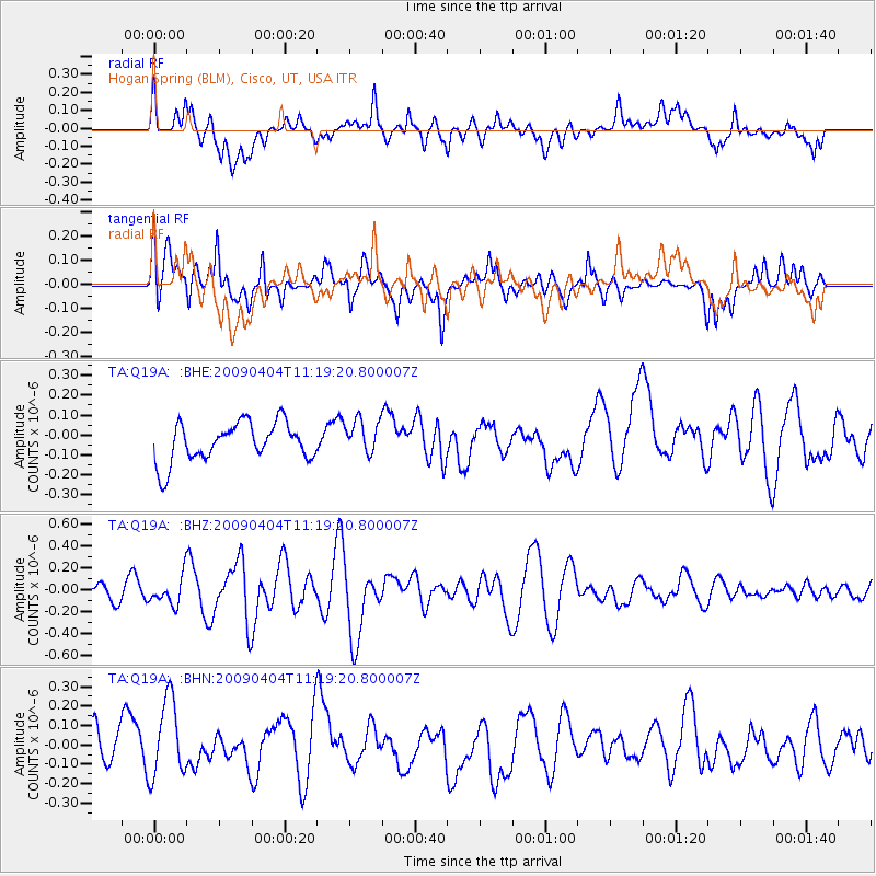
Q19A Hogan Spring (BLM), Cisco, UT, USA - Earthquake Result Viewer
*The percent match for this event was below the threshold and hence no stack was calculated.
| Earthquake location: |
Tonga Islands Region |
| Earthquake latitude/longitude: |
-22.5/-174.7 |
| Earthquake time(UTC): |
2009/04/04 (094) 11:07:12 GMT |
| Earthquake Depth: |
35 km |
| Earthquake Magnitude: |
5.5 MB, 5.4 MS, 5.5 MW, 5.5 MW |
| Earthquake Catalog/Contributor: |
WHDF/NEIC |
|
| Network: |
TA USArray Transportable Network (new EarthScope stations) |
| Station: |
Q19A Hogan Spring (BLM), Cisco, UT, USA |
| Lat/Lon: |
38.96 N/109.26 W |
| Elevation: |
1283 m |
|
| Distance: |
86.5 deg |
| Az: |
45.255 deg |
| Baz: |
237.386 deg |
| Ray Param: |
$rayparam |
*The percent match for this event was below the threshold and hence was not used in the summary stack. |
|
| Radial Match: |
48.251408 % |
| Radial Bump: |
400 |
| Transverse Match: |
60.06897 % |
| Transverse Bump: |
400 |
| SOD ConfigId: |
2760 |
| Insert Time: |
2010-03-06 05:58:04.607 +0000 |
| GWidth: |
2.5 |
| Max Bumps: |
400 |
| Tol: |
0.001 |
|
Signal To Noise
| Channel | StoN | STA | LTA |
| TA:Q19A: :BHZ:20090404T11:19:20.800007Z | 1.6074234 | 1.2871502E-7 | 8.007536E-8 |
| TA:Q19A: :BHN:20090404T11:19:20.800007Z | 1.9516985 | 2.130939E-7 | 1.09183816E-7 |
| TA:Q19A: :BHE:20090404T11:19:20.800007Z | 0.90151954 | 8.8189424E-8 | 9.782308E-8 |
| Arrivals |
| Ps | |
| PpPs | |
| PsPs/PpSs | |


