You are here: Home > Network List > CI - Caltech Regional Seismic Network Stations List
> Station MPM Manuel Prospect Mine, California, USA > Earthquake Result Viewer
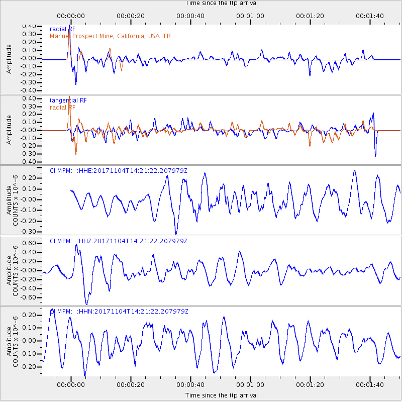
MPM Manuel Prospect Mine, California, USA - Earthquake Result Viewer
*The percent match for this event was below the threshold and hence no stack was calculated.
| Earthquake location: |
Loyalty Islands |
| Earthquake latitude/longitude: |
-21.2/168.9 |
| Earthquake time(UTC): |
2017/11/04 (308) 14:08:55 GMT |
| Earthquake Depth: |
10 km |
| Earthquake Magnitude: |
5.6 Mww |
| Earthquake Catalog/Contributor: |
NEIC PDE/us |
|
| Network: |
CI Caltech Regional Seismic Network |
| Station: |
MPM Manuel Prospect Mine, California, USA |
| Lat/Lon: |
36.06 N/117.49 W |
| Elevation: |
185 m |
|
| Distance: |
89.9 deg |
| Az: |
51.01 deg |
| Baz: |
243.483 deg |
| Ray Param: |
$rayparam |
*The percent match for this event was below the threshold and hence was not used in the summary stack. |
|
| Radial Match: |
71.97517 % |
| Radial Bump: |
400 |
| Transverse Match: |
50.277096 % |
| Transverse Bump: |
400 |
| SOD ConfigId: |
13570011 |
| Insert Time: |
2019-04-29 02:49:40.381 +0000 |
| GWidth: |
2.5 |
| Max Bumps: |
400 |
| Tol: |
0.001 |
|
Signal To Noise
| Channel | StoN | STA | LTA |
| CI:MPM: :HHZ:20171104T14:21:22.207979Z | 3.0483654 | 3.3507877E-7 | 1.099208E-7 |
| CI:MPM: :HHN:20171104T14:21:22.207979Z | 1.1333276 | 1.2640568E-7 | 1.1153498E-7 |
| CI:MPM: :HHE:20171104T14:21:22.207979Z | 2.8292177 | 1.5472455E-7 | 5.46881E-8 |
| Arrivals |
| Ps | |
| PpPs | |
| PsPs/PpSs | |


