You are here: Home > Network List > TA - USArray Transportable Network (new EarthScope stations) Stations List
> Station L15K Ungalak Mountain, AK, USA > Earthquake Result Viewer
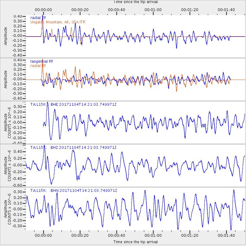
L15K Ungalak Mountain, AK, USA - Earthquake Result Viewer
*The percent match for this event was below the threshold and hence no stack was calculated.
| Earthquake location: |
Loyalty Islands |
| Earthquake latitude/longitude: |
-21.2/168.9 |
| Earthquake time(UTC): |
2017/11/04 (308) 14:08:55 GMT |
| Earthquake Depth: |
10 km |
| Earthquake Magnitude: |
5.6 Mww |
| Earthquake Catalog/Contributor: |
NEIC PDE/us |
|
| Network: |
TA USArray Transportable Network (new EarthScope stations) |
| Station: |
L15K Ungalak Mountain, AK, USA |
| Lat/Lon: |
61.68 N/161.49 W |
| Elevation: |
219 m |
|
| Distance: |
86.0 deg |
| Az: |
13.652 deg |
| Baz: |
207.496 deg |
| Ray Param: |
$rayparam |
*The percent match for this event was below the threshold and hence was not used in the summary stack. |
|
| Radial Match: |
52.087746 % |
| Radial Bump: |
400 |
| Transverse Match: |
51.010395 % |
| Transverse Bump: |
400 |
| SOD ConfigId: |
13570011 |
| Insert Time: |
2019-04-29 02:51:27.188 +0000 |
| GWidth: |
2.5 |
| Max Bumps: |
400 |
| Tol: |
0.001 |
|
Signal To Noise
| Channel | StoN | STA | LTA |
| TA:L15K: :BHZ:20171104T14:21:03.749971Z | 2.8498347 | 3.3481174E-7 | 1.17484625E-7 |
| TA:L15K: :BHN:20171104T14:21:03.749971Z | 0.9330471 | 1.3257379E-7 | 1.4208692E-7 |
| TA:L15K: :BHE:20171104T14:21:03.749971Z | 0.3432956 | 5.2915734E-8 | 1.5414044E-7 |
| Arrivals |
| Ps | |
| PpPs | |
| PsPs/PpSs | |


