You are here: Home > Network List > TA - USArray Transportable Network (new EarthScope stations) Stations List
> Station P17K Kvichak River, AK, USA > Earthquake Result Viewer
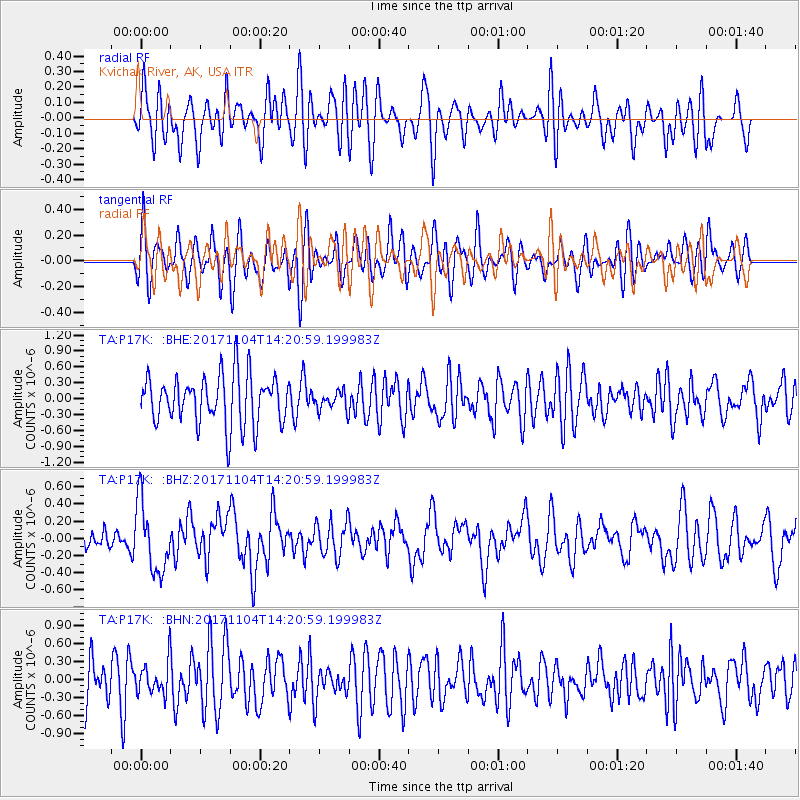
P17K Kvichak River, AK, USA - Earthquake Result Viewer
*The percent match for this event was below the threshold and hence no stack was calculated.
| Earthquake location: |
Loyalty Islands |
| Earthquake latitude/longitude: |
-21.2/168.9 |
| Earthquake time(UTC): |
2017/11/04 (308) 14:08:55 GMT |
| Earthquake Depth: |
10 km |
| Earthquake Magnitude: |
5.6 Mww |
| Earthquake Catalog/Contributor: |
NEIC PDE/us |
|
| Network: |
TA USArray Transportable Network (new EarthScope stations) |
| Station: |
P17K Kvichak River, AK, USA |
| Lat/Lon: |
59.20 N/156.44 W |
| Elevation: |
91 m |
|
| Distance: |
85.1 deg |
| Az: |
17.072 deg |
| Baz: |
212.148 deg |
| Ray Param: |
$rayparam |
*The percent match for this event was below the threshold and hence was not used in the summary stack. |
|
| Radial Match: |
50.407024 % |
| Radial Bump: |
400 |
| Transverse Match: |
53.309814 % |
| Transverse Bump: |
400 |
| SOD ConfigId: |
13570011 |
| Insert Time: |
2019-04-29 02:51:44.068 +0000 |
| GWidth: |
2.5 |
| Max Bumps: |
400 |
| Tol: |
0.001 |
|
Signal To Noise
| Channel | StoN | STA | LTA |
| TA:P17K: :BHZ:20171104T14:20:59.199983Z | 2.5864832 | 4.0283655E-7 | 1.5574683E-7 |
| TA:P17K: :BHN:20171104T14:20:59.199983Z | 0.7876467 | 2.6546638E-7 | 3.370374E-7 |
| TA:P17K: :BHE:20171104T14:20:59.199983Z | 0.39488152 | 1.8371837E-7 | 4.6524934E-7 |
| Arrivals |
| Ps | |
| PpPs | |
| PsPs/PpSs | |


