You are here: Home > Network List > US - United States National Seismic Network Stations List
> Station AMTX Amarillo, Texas, USA > Earthquake Result Viewer
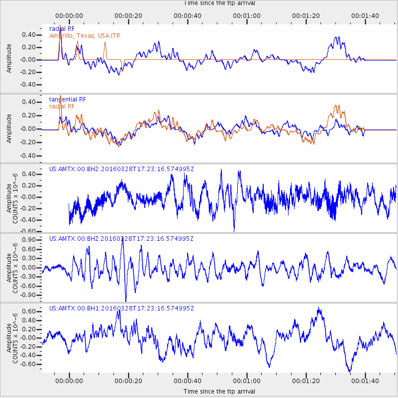
AMTX Amarillo, Texas, USA - Earthquake Result Viewer
*The percent match for this event was below the threshold and hence no stack was calculated.
| Earthquake location: |
Fox Islands, Aleutian Islands |
| Earthquake latitude/longitude: |
52.3/-168.7 |
| Earthquake time(UTC): |
2016/03/28 (088) 17:14:55 GMT |
| Earthquake Depth: |
10 km |
| Earthquake Magnitude: |
5.5 MB, 5.6 MWC, 5.6 MWB |
| Earthquake Catalog/Contributor: |
NEIC PDE/NEIC COMCAT |
|
| Network: |
US United States National Seismic Network |
| Station: |
AMTX Amarillo, Texas, USA |
| Lat/Lon: |
34.53 N/101.41 W |
| Elevation: |
1010 m |
|
| Distance: |
50.1 deg |
| Az: |
82.906 deg |
| Baz: |
312.435 deg |
| Ray Param: |
$rayparam |
*The percent match for this event was below the threshold and hence was not used in the summary stack. |
|
| Radial Match: |
42.62462 % |
| Radial Bump: |
400 |
| Transverse Match: |
30.93916 % |
| Transverse Bump: |
400 |
| SOD ConfigId: |
1475611 |
| Insert Time: |
2016-04-11 17:58:18.318 +0000 |
| GWidth: |
2.5 |
| Max Bumps: |
400 |
| Tol: |
0.001 |
|
Signal To Noise
| Channel | StoN | STA | LTA |
| US:AMTX:00:BHZ:20160328T17:23:16.574995Z | 2.1899004 | 2.218481E-7 | 1.0130511E-7 |
| US:AMTX:00:BH1:20160328T17:23:16.574995Z | 0.5828205 | 1.3066365E-7 | 2.2419194E-7 |
| US:AMTX:00:BH2:20160328T17:23:16.574995Z | 1.5315629 | 2.217817E-7 | 1.4480744E-7 |
| Arrivals |
| Ps | |
| PpPs | |
| PsPs/PpSs | |


