You are here: Home > Network List > TA - USArray Transportable Network (new EarthScope stations) Stations List
> Station P17K Kvichak River, AK, USA > Earthquake Result Viewer
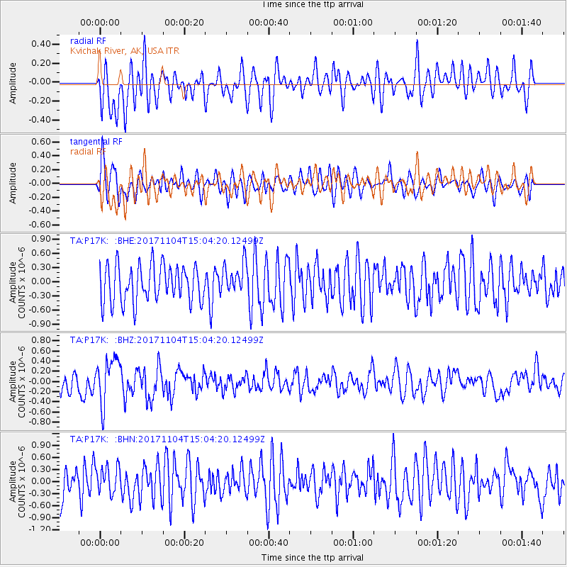
P17K Kvichak River, AK, USA - Earthquake Result Viewer
*The percent match for this event was below the threshold and hence no stack was calculated.
| Earthquake location: |
Southeast Of Loyalty Islands |
| Earthquake latitude/longitude: |
-21.7/169.1 |
| Earthquake time(UTC): |
2017/11/04 (308) 14:52:14 GMT |
| Earthquake Depth: |
10 km |
| Earthquake Magnitude: |
5.4 Mww |
| Earthquake Catalog/Contributor: |
NEIC PDE/us |
|
| Network: |
TA USArray Transportable Network (new EarthScope stations) |
| Station: |
P17K Kvichak River, AK, USA |
| Lat/Lon: |
59.20 N/156.44 W |
| Elevation: |
91 m |
|
| Distance: |
85.4 deg |
| Az: |
16.978 deg |
| Baz: |
211.851 deg |
| Ray Param: |
$rayparam |
*The percent match for this event was below the threshold and hence was not used in the summary stack. |
|
| Radial Match: |
56.53703 % |
| Radial Bump: |
400 |
| Transverse Match: |
42.509346 % |
| Transverse Bump: |
400 |
| SOD ConfigId: |
13570011 |
| Insert Time: |
2019-04-29 02:56:07.129 +0000 |
| GWidth: |
2.5 |
| Max Bumps: |
400 |
| Tol: |
0.001 |
|
Signal To Noise
| Channel | StoN | STA | LTA |
| TA:P17K: :BHZ:20171104T15:04:20.12499Z | 2.248604 | 4.5168306E-7 | 2.0087265E-7 |
| TA:P17K: :BHN:20171104T15:04:20.12499Z | 0.889447 | 3.342574E-7 | 3.7580364E-7 |
| TA:P17K: :BHE:20171104T15:04:20.12499Z | 0.8701305 | 3.3749822E-7 | 3.878708E-7 |
| Arrivals |
| Ps | |
| PpPs | |
| PsPs/PpSs | |


