You are here: Home > Network List > US - United States National Seismic Network Stations List
> Station MNTX Cornudas Mountains, Texas, USA > Earthquake Result Viewer
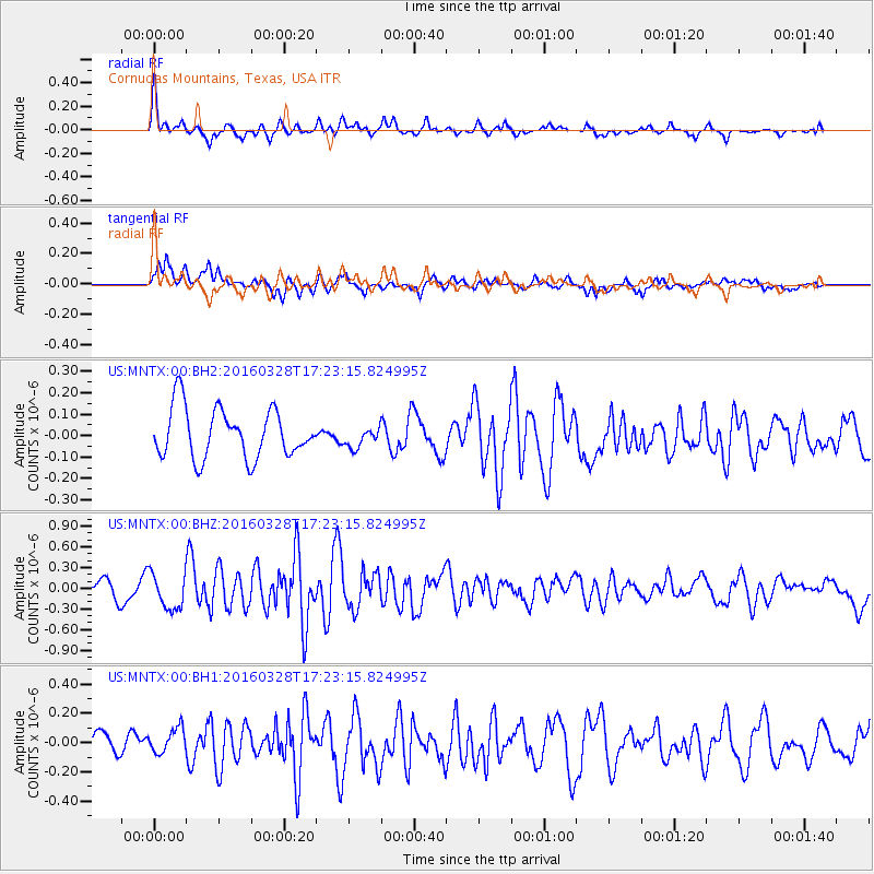
MNTX Cornudas Mountains, Texas, USA - Earthquake Result Viewer
*The percent match for this event was below the threshold and hence no stack was calculated.
| Earthquake location: |
Fox Islands, Aleutian Islands |
| Earthquake latitude/longitude: |
52.3/-168.7 |
| Earthquake time(UTC): |
2016/03/28 (088) 17:14:55 GMT |
| Earthquake Depth: |
10 km |
| Earthquake Magnitude: |
5.5 MB, 5.6 MWC, 5.6 MWB |
| Earthquake Catalog/Contributor: |
NEIC PDE/NEIC COMCAT |
|
| Network: |
US United States National Seismic Network |
| Station: |
MNTX Cornudas Mountains, Texas, USA |
| Lat/Lon: |
31.70 N/105.38 W |
| Elevation: |
404 m |
|
| Distance: |
49.6 deg |
| Az: |
88.584 deg |
| Baz: |
313.934 deg |
| Ray Param: |
$rayparam |
*The percent match for this event was below the threshold and hence was not used in the summary stack. |
|
| Radial Match: |
65.21153 % |
| Radial Bump: |
388 |
| Transverse Match: |
66.49692 % |
| Transverse Bump: |
400 |
| SOD ConfigId: |
1475611 |
| Insert Time: |
2016-04-11 18:03:15.893 +0000 |
| GWidth: |
2.5 |
| Max Bumps: |
400 |
| Tol: |
0.001 |
|
Signal To Noise
| Channel | StoN | STA | LTA |
| US:MNTX:00:BHZ:20160328T17:23:15.824995Z | 2.6057177 | 2.5837437E-7 | 9.91567E-8 |
| US:MNTX:00:BH1:20160328T17:23:15.824995Z | 1.1848625 | 8.8856964E-8 | 7.499348E-8 |
| US:MNTX:00:BH2:20160328T17:23:15.824995Z | 0.41106346 | 4.7398352E-8 | 1.1530665E-7 |
| Arrivals |
| Ps | |
| PpPs | |
| PsPs/PpSs | |


