You are here: Home > Network List > TA - USArray Transportable Network (new EarthScope stations) Stations List
> Station Q19A Hogan Spring (BLM), Cisco, UT, USA > Earthquake Result Viewer
Q19A Hogan Spring (BLM), Cisco, UT, USA - Earthquake Result Viewer
*The percent match for this event was below the threshold and hence no stack was calculated.
| Earthquake location: |
Near East Coast Of Honshu, Japan |
| Earthquake latitude/longitude: |
36.7/141.1 |
| Earthquake time(UTC): |
2009/01/31 (031) 21:51:52 GMT |
| Earthquake Depth: |
34 km |
| Earthquake Magnitude: |
5.6 MB, 5.3 MS, 5.8 MW, 5.7 MW |
| Earthquake Catalog/Contributor: |
WHDF/NEIC |
|
| Network: |
TA USArray Transportable Network (new EarthScope stations) |
| Station: |
Q19A Hogan Spring (BLM), Cisco, UT, USA |
| Lat/Lon: |
38.96 N/109.26 W |
| Elevation: |
1283 m |
|
| Distance: |
80.6 deg |
| Az: |
48.115 deg |
| Baz: |
309.895 deg |
| Ray Param: |
$rayparam |
*The percent match for this event was below the threshold and hence was not used in the summary stack. |
|
| Radial Match: |
75.030235 % |
| Radial Bump: |
400 |
| Transverse Match: |
61.33095 % |
| Transverse Bump: |
400 |
| SOD ConfigId: |
2658 |
| Insert Time: |
2010-03-06 05:59:35.073 +0000 |
| GWidth: |
2.5 |
| Max Bumps: |
400 |
| Tol: |
0.001 |
|
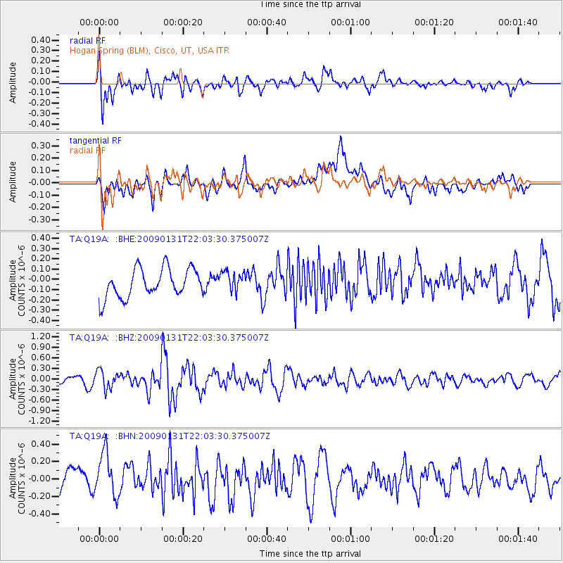
Signal To Noise
| Channel | StoN | STA | LTA |
| TA:Q19A: :BHZ:20090131T22:03:30.375007Z | 2.5180955 | 2.5673197E-7 | 1.0195482E-7 |
| TA:Q19A: :BHN:20090131T22:03:30.375007Z | 1.7590873 | 2.7874765E-7 | 1.584615E-7 |
| TA:Q19A: :BHE:20090131T22:03:30.375007Z | 0.715088 | 9.943515E-8 | 1.3905301E-7 |
| Arrivals |
| Ps | |
| PpPs | |
| PsPs/PpSs | |


