You are here: Home > Network List > CI - Caltech Regional Seismic Network Stations List
> Station MPP McPhearson Peak > Earthquake Result Viewer
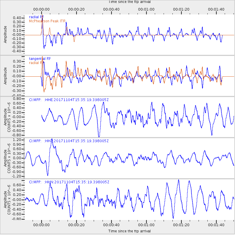
MPP McPhearson Peak - Earthquake Result Viewer
*The percent match for this event was below the threshold and hence no stack was calculated.
| Earthquake location: |
Tonga Islands |
| Earthquake latitude/longitude: |
-15.2/-173.3 |
| Earthquake time(UTC): |
2017/11/04 (308) 15:24:31 GMT |
| Earthquake Depth: |
10 km |
| Earthquake Magnitude: |
5.6 mb |
| Earthquake Catalog/Contributor: |
NEIC PDE/us |
|
| Network: |
CI Caltech Regional Seismic Network |
| Station: |
MPP McPhearson Peak |
| Lat/Lon: |
34.89 N/119.81 W |
| Elevation: |
1739 m |
|
| Distance: |
71.1 deg |
| Az: |
44.316 deg |
| Baz: |
235.139 deg |
| Ray Param: |
$rayparam |
*The percent match for this event was below the threshold and hence was not used in the summary stack. |
|
| Radial Match: |
49.1931 % |
| Radial Bump: |
400 |
| Transverse Match: |
57.73384 % |
| Transverse Bump: |
400 |
| SOD ConfigId: |
13570011 |
| Insert Time: |
2019-04-29 03:00:12.594 +0000 |
| GWidth: |
2.5 |
| Max Bumps: |
400 |
| Tol: |
0.001 |
|
Signal To Noise
| Channel | StoN | STA | LTA |
| CI:MPP: :HHZ:20171104T15:35:19.398005Z | 2.2146447 | 5.0523846E-7 | 2.2813524E-7 |
| CI:MPP: :HHN:20171104T15:35:19.398005Z | 1.0675917 | 3.0427168E-7 | 2.8500756E-7 |
| CI:MPP: :HHE:20171104T15:35:19.398005Z | 2.0313518 | 4.7188655E-7 | 2.3230173E-7 |
| Arrivals |
| Ps | |
| PpPs | |
| PsPs/PpSs | |


