You are here: Home > Network List > CI - Caltech Regional Seismic Network Stations List
> Station SWS Sam W. Stewart, Westmorland, CA, USA > Earthquake Result Viewer
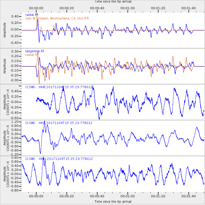
SWS Sam W. Stewart, Westmorland, CA, USA - Earthquake Result Viewer
*The percent match for this event was below the threshold and hence no stack was calculated.
| Earthquake location: |
Tonga Islands |
| Earthquake latitude/longitude: |
-15.2/-173.3 |
| Earthquake time(UTC): |
2017/11/04 (308) 15:24:31 GMT |
| Earthquake Depth: |
10 km |
| Earthquake Magnitude: |
5.6 mb |
| Earthquake Catalog/Contributor: |
NEIC PDE/us |
|
| Network: |
CI Caltech Regional Seismic Network |
| Station: |
SWS Sam W. Stewart, Westmorland, CA, USA |
| Lat/Lon: |
32.94 N/115.80 W |
| Elevation: |
140 m |
|
| Distance: |
72.8 deg |
| Az: |
47.948 deg |
| Baz: |
238.495 deg |
| Ray Param: |
$rayparam |
*The percent match for this event was below the threshold and hence was not used in the summary stack. |
|
| Radial Match: |
69.76904 % |
| Radial Bump: |
400 |
| Transverse Match: |
42.40052 % |
| Transverse Bump: |
350 |
| SOD ConfigId: |
13570011 |
| Insert Time: |
2019-04-29 03:00:24.361 +0000 |
| GWidth: |
2.5 |
| Max Bumps: |
400 |
| Tol: |
0.001 |
|
Signal To Noise
| Channel | StoN | STA | LTA |
| CI:SWS: :HHZ:20171104T15:35:29.77801Z | 4.151151 | 4.89221E-7 | 1.1785188E-7 |
| CI:SWS: :HHN:20171104T15:35:29.77801Z | 2.0677722 | 4.5579543E-7 | 2.2042826E-7 |
| CI:SWS: :HHE:20171104T15:35:29.77801Z | 0.8242411 | 1.8600778E-7 | 2.2567156E-7 |
| Arrivals |
| Ps | |
| PpPs | |
| PsPs/PpSs | |


