You are here: Home > Network List > CN - Canadian National Seismograph Network Stations List
> Station INK INUVIK, NT > Earthquake Result Viewer
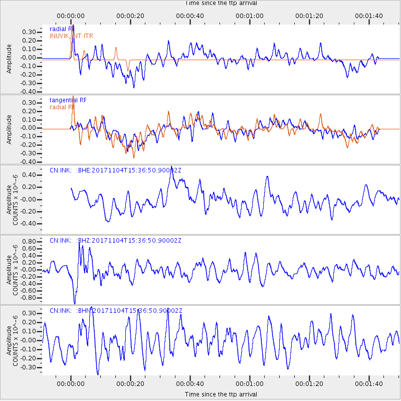
INK INUVIK, NT - Earthquake Result Viewer
*The percent match for this event was below the threshold and hence no stack was calculated.
| Earthquake location: |
Tonga Islands |
| Earthquake latitude/longitude: |
-15.2/-173.3 |
| Earthquake time(UTC): |
2017/11/04 (308) 15:24:31 GMT |
| Earthquake Depth: |
10 km |
| Earthquake Magnitude: |
5.6 mb |
| Earthquake Catalog/Contributor: |
NEIC PDE/us |
|
| Network: |
CN Canadian National Seismograph Network |
| Station: |
INK INUVIK, NT |
| Lat/Lon: |
68.31 N/133.53 W |
| Elevation: |
44 m |
|
| Distance: |
88.0 deg |
| Az: |
13.778 deg |
| Baz: |
218.209 deg |
| Ray Param: |
$rayparam |
*The percent match for this event was below the threshold and hence was not used in the summary stack. |
|
| Radial Match: |
61.276268 % |
| Radial Bump: |
400 |
| Transverse Match: |
46.771458 % |
| Transverse Bump: |
400 |
| SOD ConfigId: |
13570011 |
| Insert Time: |
2019-04-29 03:00:38.464 +0000 |
| GWidth: |
2.5 |
| Max Bumps: |
400 |
| Tol: |
0.001 |
|
Signal To Noise
| Channel | StoN | STA | LTA |
| CN:INK: :BHZ:20171104T15:36:50.90002Z | 3.2912743 | 4.848255E-7 | 1.4730632E-7 |
| CN:INK: :BHN:20171104T15:36:50.90002Z | 1.3292081 | 1.39481E-7 | 1.0493541E-7 |
| CN:INK: :BHE:20171104T15:36:50.90002Z | 1.980718 | 2.8664644E-7 | 1.4471844E-7 |
| Arrivals |
| Ps | |
| PpPs | |
| PsPs/PpSs | |


