You are here: Home > Network List > TA - USArray Transportable Network (new EarthScope stations) Stations List
> Station G31M Satah River, YT, CAN > Earthquake Result Viewer
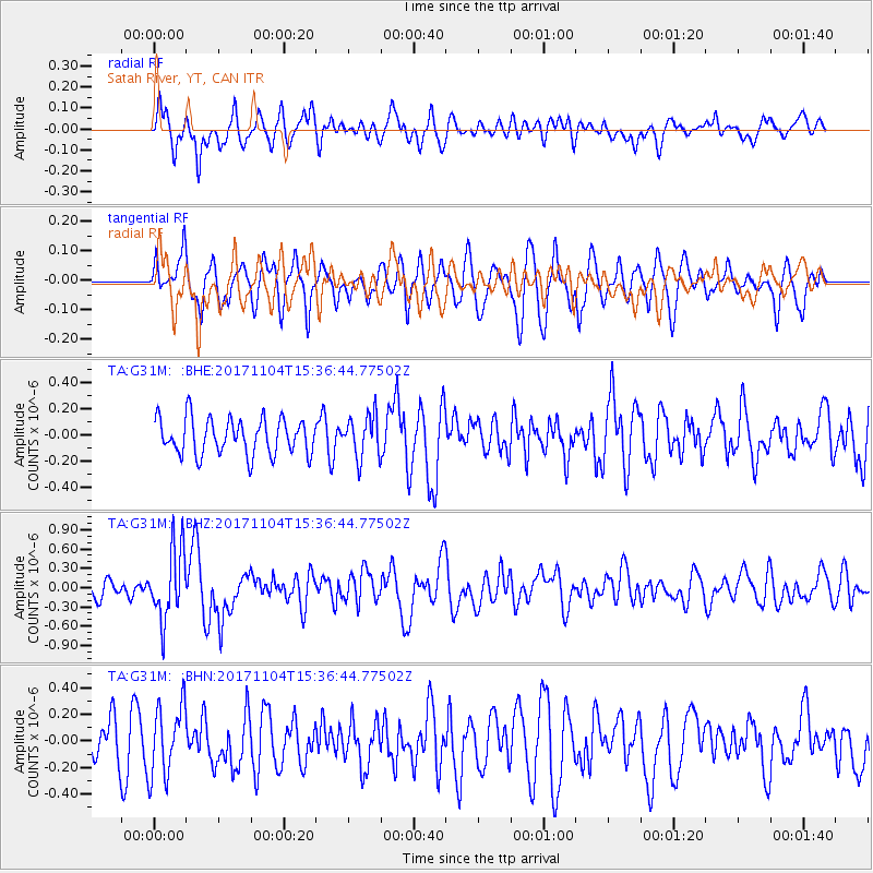
G31M Satah River, YT, CAN - Earthquake Result Viewer
*The percent match for this event was below the threshold and hence no stack was calculated.
| Earthquake location: |
Tonga Islands |
| Earthquake latitude/longitude: |
-15.2/-173.3 |
| Earthquake time(UTC): |
2017/11/04 (308) 15:24:31 GMT |
| Earthquake Depth: |
10 km |
| Earthquake Magnitude: |
5.6 mb |
| Earthquake Catalog/Contributor: |
NEIC PDE/us |
|
| Network: |
TA USArray Transportable Network (new EarthScope stations) |
| Station: |
G31M Satah River, YT, CAN |
| Lat/Lon: |
66.92 N/134.27 W |
| Elevation: |
61 m |
|
| Distance: |
86.8 deg |
| Az: |
14.407 deg |
| Baz: |
217.548 deg |
| Ray Param: |
$rayparam |
*The percent match for this event was below the threshold and hence was not used in the summary stack. |
|
| Radial Match: |
61.851772 % |
| Radial Bump: |
400 |
| Transverse Match: |
52.111412 % |
| Transverse Bump: |
400 |
| SOD ConfigId: |
13570011 |
| Insert Time: |
2019-04-29 03:04:34.465 +0000 |
| GWidth: |
2.5 |
| Max Bumps: |
400 |
| Tol: |
0.001 |
|
Signal To Noise
| Channel | StoN | STA | LTA |
| TA:G31M: :BHZ:20171104T15:36:44.77502Z | 3.19507 | 5.5128334E-7 | 1.7254186E-7 |
| TA:G31M: :BHN:20171104T15:36:44.77502Z | 1.9218773 | 2.670581E-7 | 1.389569E-7 |
| TA:G31M: :BHE:20171104T15:36:44.77502Z | 1.1123283 | 1.5365953E-7 | 1.3814224E-7 |
| Arrivals |
| Ps | |
| PpPs | |
| PsPs/PpSs | |


