You are here: Home > Network List > TA - USArray Transportable Network (new EarthScope stations) Stations List
> Station J26L Joseph Creek, AK, USA > Earthquake Result Viewer
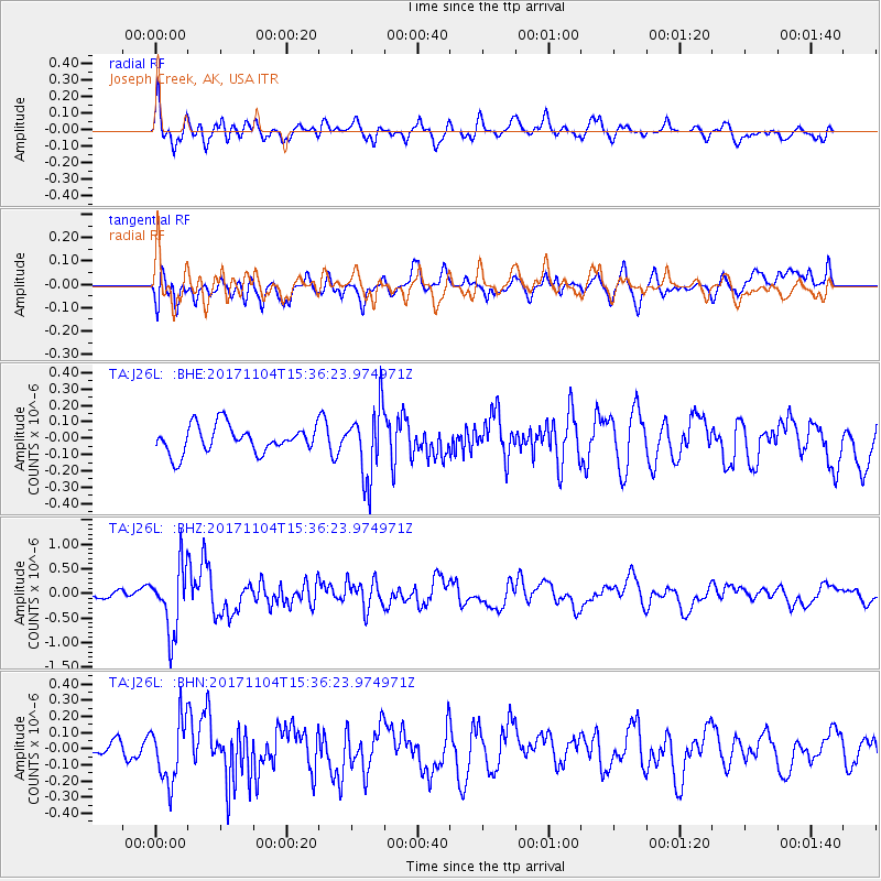
J26L Joseph Creek, AK, USA - Earthquake Result Viewer
*The percent match for this event was below the threshold and hence no stack was calculated.
| Earthquake location: |
Tonga Islands |
| Earthquake latitude/longitude: |
-15.2/-173.3 |
| Earthquake time(UTC): |
2017/11/04 (308) 15:24:31 GMT |
| Earthquake Depth: |
10 km |
| Earthquake Magnitude: |
5.6 mb |
| Earthquake Catalog/Contributor: |
NEIC PDE/us |
|
| Network: |
TA USArray Transportable Network (new EarthScope stations) |
| Station: |
J26L Joseph Creek, AK, USA |
| Lat/Lon: |
64.50 N/143.56 W |
| Elevation: |
1144 m |
|
| Distance: |
82.6 deg |
| Az: |
12.516 deg |
| Baz: |
208.908 deg |
| Ray Param: |
$rayparam |
*The percent match for this event was below the threshold and hence was not used in the summary stack. |
|
| Radial Match: |
71.97454 % |
| Radial Bump: |
400 |
| Transverse Match: |
60.921772 % |
| Transverse Bump: |
400 |
| SOD ConfigId: |
13570011 |
| Insert Time: |
2019-04-29 03:04:57.311 +0000 |
| GWidth: |
2.5 |
| Max Bumps: |
400 |
| Tol: |
0.001 |
|
Signal To Noise
| Channel | StoN | STA | LTA |
| TA:J26L: :BHZ:20171104T15:36:23.974971Z | 5.52493 | 6.698825E-7 | 1.2124724E-7 |
| TA:J26L: :BHN:20171104T15:36:23.974971Z | 3.9441853 | 1.9090352E-7 | 4.8401258E-8 |
| TA:J26L: :BHE:20171104T15:36:23.974971Z | 2.4983113 | 2.0504837E-7 | 8.207479E-8 |
| Arrivals |
| Ps | |
| PpPs | |
| PsPs/PpSs | |


