You are here: Home > Network List > TA - USArray Transportable Network (new EarthScope stations) Stations List
> Station M11K Mekoryuk, AK, USA > Earthquake Result Viewer
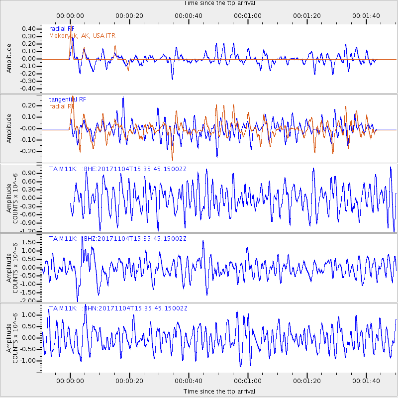
M11K Mekoryuk, AK, USA - Earthquake Result Viewer
*The percent match for this event was below the threshold and hence no stack was calculated.
| Earthquake location: |
Tonga Islands |
| Earthquake latitude/longitude: |
-15.2/-173.3 |
| Earthquake time(UTC): |
2017/11/04 (308) 15:24:31 GMT |
| Earthquake Depth: |
10 km |
| Earthquake Magnitude: |
5.6 mb |
| Earthquake Catalog/Contributor: |
NEIC PDE/us |
|
| Network: |
TA USArray Transportable Network (new EarthScope stations) |
| Station: |
M11K Mekoryuk, AK, USA |
| Lat/Lon: |
60.38 N/166.20 W |
| Elevation: |
3.0 m |
|
| Distance: |
75.5 deg |
| Az: |
3.652 deg |
| Baz: |
187.113 deg |
| Ray Param: |
$rayparam |
*The percent match for this event was below the threshold and hence was not used in the summary stack. |
|
| Radial Match: |
54.514362 % |
| Radial Bump: |
386 |
| Transverse Match: |
52.02599 % |
| Transverse Bump: |
400 |
| SOD ConfigId: |
13570011 |
| Insert Time: |
2019-04-29 03:05:15.623 +0000 |
| GWidth: |
2.5 |
| Max Bumps: |
400 |
| Tol: |
0.001 |
|
Signal To Noise
| Channel | StoN | STA | LTA |
| TA:M11K: :BHZ:20171104T15:35:45.15002Z | 2.3097832 | 8.8854887E-7 | 3.846893E-7 |
| TA:M11K: :BHN:20171104T15:35:45.15002Z | 1.2677476 | 5.2564155E-7 | 4.1462636E-7 |
| TA:M11K: :BHE:20171104T15:35:45.15002Z | 0.90921223 | 4.333027E-7 | 4.7656934E-7 |
| Arrivals |
| Ps | |
| PpPs | |
| PsPs/PpSs | |


