You are here: Home > Network List > TA - USArray Transportable Network (new EarthScope stations) Stations List
> Station O17K Koliganek, Bristol Bay, AK, USA > Earthquake Result Viewer
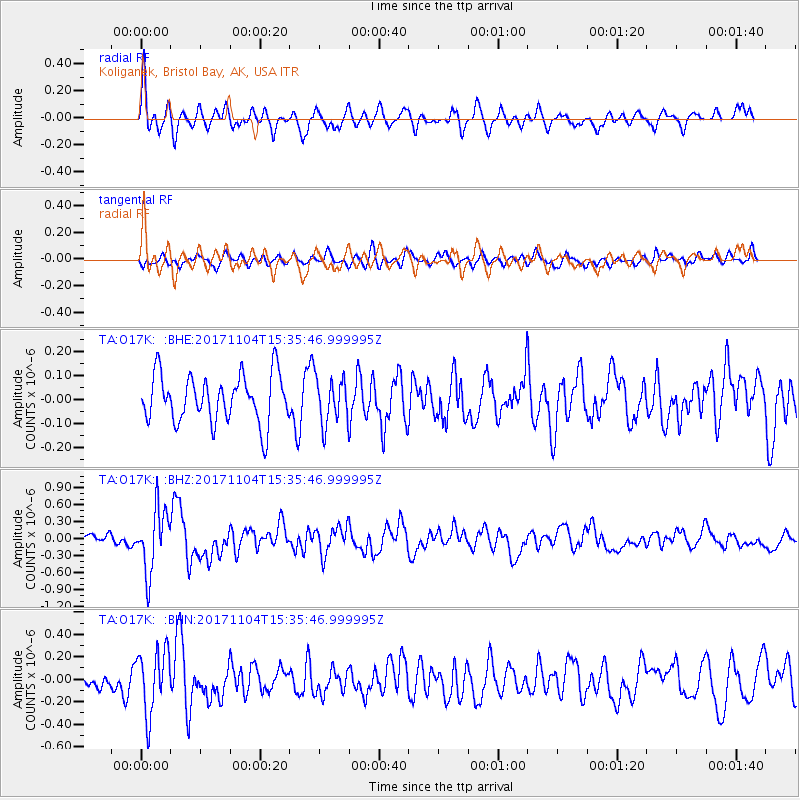
O17K Koliganek, Bristol Bay, AK, USA - Earthquake Result Viewer
*The percent match for this event was below the threshold and hence no stack was calculated.
| Earthquake location: |
Tonga Islands |
| Earthquake latitude/longitude: |
-15.2/-173.3 |
| Earthquake time(UTC): |
2017/11/04 (308) 15:24:31 GMT |
| Earthquake Depth: |
10 km |
| Earthquake Magnitude: |
5.6 mb |
| Earthquake Catalog/Contributor: |
NEIC PDE/us |
|
| Network: |
TA USArray Transportable Network (new EarthScope stations) |
| Station: |
O17K Koliganek, Bristol Bay, AK, USA |
| Lat/Lon: |
59.77 N/157.09 W |
| Elevation: |
156 m |
|
| Distance: |
75.8 deg |
| Az: |
8.391 deg |
| Baz: |
196.169 deg |
| Ray Param: |
$rayparam |
*The percent match for this event was below the threshold and hence was not used in the summary stack. |
|
| Radial Match: |
72.12729 % |
| Radial Bump: |
400 |
| Transverse Match: |
46.829525 % |
| Transverse Bump: |
400 |
| SOD ConfigId: |
13570011 |
| Insert Time: |
2019-04-29 03:05:39.176 +0000 |
| GWidth: |
2.5 |
| Max Bumps: |
400 |
| Tol: |
0.001 |
|
Signal To Noise
| Channel | StoN | STA | LTA |
| TA:O17K: :BHZ:20171104T15:35:46.999995Z | 5.3482966 | 5.477731E-7 | 1.024201E-7 |
| TA:O17K: :BHN:20171104T15:35:46.999995Z | 3.445508 | 2.7966374E-7 | 8.1167634E-8 |
| TA:O17K: :BHE:20171104T15:35:46.999995Z | 1.0128121 | 1.00779076E-7 | 9.950421E-8 |
| Arrivals |
| Ps | |
| PpPs | |
| PsPs/PpSs | |


