You are here: Home > Network List > TA - USArray Transportable Network (new EarthScope stations) Stations List
> Station T25A Trinidad, CO, USA > Earthquake Result Viewer
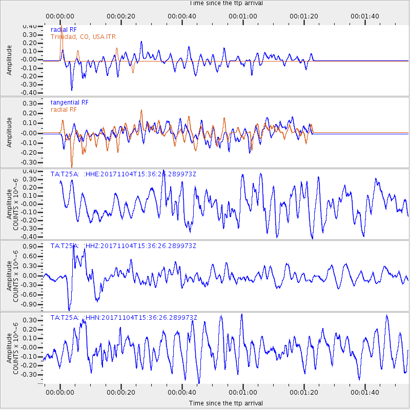
T25A Trinidad, CO, USA - Earthquake Result Viewer
*The percent match for this event was below the threshold and hence no stack was calculated.
| Earthquake location: |
Tonga Islands |
| Earthquake latitude/longitude: |
-15.2/-173.3 |
| Earthquake time(UTC): |
2017/11/04 (308) 15:24:31 GMT |
| Earthquake Depth: |
10 km |
| Earthquake Magnitude: |
5.6 mb |
| Earthquake Catalog/Contributor: |
NEIC PDE/us |
|
| Network: |
TA USArray Transportable Network (new EarthScope stations) |
| Station: |
T25A Trinidad, CO, USA |
| Lat/Lon: |
37.14 N/104.41 W |
| Elevation: |
2017 m |
|
| Distance: |
83.0 deg |
| Az: |
48.693 deg |
| Baz: |
245.178 deg |
| Ray Param: |
$rayparam |
*The percent match for this event was below the threshold and hence was not used in the summary stack. |
|
| Radial Match: |
66.075615 % |
| Radial Bump: |
400 |
| Transverse Match: |
43.237675 % |
| Transverse Bump: |
400 |
| SOD ConfigId: |
13570011 |
| Insert Time: |
2019-04-29 03:05:58.431 +0000 |
| GWidth: |
2.5 |
| Max Bumps: |
400 |
| Tol: |
0.001 |
|
Signal To Noise
| Channel | StoN | STA | LTA |
| TA:T25A: :HHZ:20171104T15:36:26.289973Z | 3.0177927 | 4.9927746E-7 | 1.654446E-7 |
| TA:T25A: :HHN:20171104T15:36:26.289973Z | 1.363874 | 1.3670011E-7 | 1.00229286E-7 |
| TA:T25A: :HHE:20171104T15:36:26.289973Z | 1.5741884 | 2.0329706E-7 | 1.2914404E-7 |
| Arrivals |
| Ps | |
| PpPs | |
| PsPs/PpSs | |


