You are here: Home > Network List > UW - Pacific Northwest Regional Seismic Network Stations List
> Station LCCR Mulino, OR, USA > Earthquake Result Viewer
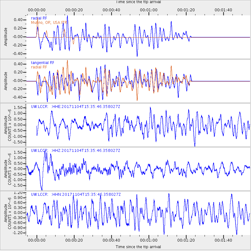
LCCR Mulino, OR, USA - Earthquake Result Viewer
*The percent match for this event was below the threshold and hence no stack was calculated.
| Earthquake location: |
Tonga Islands |
| Earthquake latitude/longitude: |
-15.2/-173.3 |
| Earthquake time(UTC): |
2017/11/04 (308) 15:24:31 GMT |
| Earthquake Depth: |
10 km |
| Earthquake Magnitude: |
5.6 mb |
| Earthquake Catalog/Contributor: |
NEIC PDE/us |
|
| Network: |
UW Pacific Northwest Regional Seismic Network |
| Station: |
LCCR Mulino, OR, USA |
| Lat/Lon: |
45.21 N/122.48 W |
| Elevation: |
273 m |
|
| Distance: |
75.7 deg |
| Az: |
34.456 deg |
| Baz: |
230.601 deg |
| Ray Param: |
$rayparam |
*The percent match for this event was below the threshold and hence was not used in the summary stack. |
|
| Radial Match: |
67.45158 % |
| Radial Bump: |
400 |
| Transverse Match: |
65.28021 % |
| Transverse Bump: |
400 |
| SOD ConfigId: |
13570011 |
| Insert Time: |
2019-04-29 03:06:54.282 +0000 |
| GWidth: |
2.5 |
| Max Bumps: |
400 |
| Tol: |
0.001 |
|
Signal To Noise
| Channel | StoN | STA | LTA |
| UW:LCCR: :HHZ:20171104T15:35:46.358027Z | 4.526835 | 9.845112E-7 | 2.1748333E-7 |
| UW:LCCR: :HHN:20171104T15:35:46.358027Z | 1.611939 | 4.4435146E-7 | 2.7566273E-7 |
| UW:LCCR: :HHE:20171104T15:35:46.358027Z | 0.36364874 | 1.8211975E-7 | 5.008123E-7 |
| Arrivals |
| Ps | |
| PpPs | |
| PsPs/PpSs | |


