You are here: Home > Network List > UW - Pacific Northwest Regional Seismic Network Stations List
> Station UMAT Pilot Rock, OR, USA > Earthquake Result Viewer
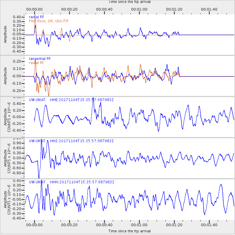
UMAT Pilot Rock, OR, USA - Earthquake Result Viewer
*The percent match for this event was below the threshold and hence no stack was calculated.
| Earthquake location: |
Tonga Islands |
| Earthquake latitude/longitude: |
-15.2/-173.3 |
| Earthquake time(UTC): |
2017/11/04 (308) 15:24:31 GMT |
| Earthquake Depth: |
10 km |
| Earthquake Magnitude: |
5.6 mb |
| Earthquake Catalog/Contributor: |
NEIC PDE/us |
|
| Network: |
UW Pacific Northwest Regional Seismic Network |
| Station: |
UMAT Pilot Rock, OR, USA |
| Lat/Lon: |
45.29 N/118.96 W |
| Elevation: |
1318 m |
|
| Distance: |
77.7 deg |
| Az: |
35.96 deg |
| Baz: |
233.437 deg |
| Ray Param: |
$rayparam |
*The percent match for this event was below the threshold and hence was not used in the summary stack. |
|
| Radial Match: |
66.93427 % |
| Radial Bump: |
400 |
| Transverse Match: |
48.41477 % |
| Transverse Bump: |
375 |
| SOD ConfigId: |
13570011 |
| Insert Time: |
2019-04-29 03:07:06.247 +0000 |
| GWidth: |
2.5 |
| Max Bumps: |
400 |
| Tol: |
0.001 |
|
Signal To Noise
| Channel | StoN | STA | LTA |
| UW:UMAT: :HHZ:20171104T15:35:57.687983Z | 4.134923 | 5.4020603E-7 | 1.3064476E-7 |
| UW:UMAT: :HHN:20171104T15:35:57.687983Z | 1.8462003 | 1.6944577E-7 | 9.1780805E-8 |
| UW:UMAT: :HHE:20171104T15:35:57.687983Z | 1.6057165 | 2.3208241E-7 | 1.4453511E-7 |
| Arrivals |
| Ps | |
| PpPs | |
| PsPs/PpSs | |


