You are here: Home > Network List > TA - USArray Transportable Network (new EarthScope stations) Stations List
> Station Q18A Rafter H Ranch, Green River, UT, USA > Earthquake Result Viewer
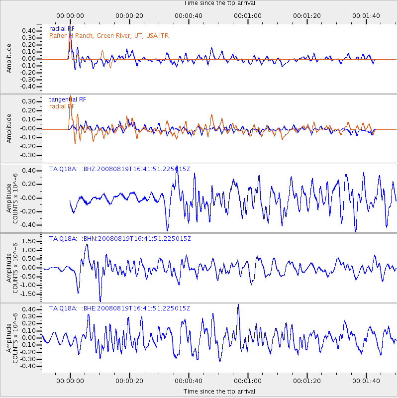
Q18A Rafter H Ranch, Green River, UT, USA - Earthquake Result Viewer
*The percent match for this event was below the threshold and hence no stack was calculated.
| Earthquake location: |
Tonga Islands |
| Earthquake latitude/longitude: |
-15.1/-173.5 |
| Earthquake time(UTC): |
2008/08/19 (232) 16:30:13 GMT |
| Earthquake Depth: |
8.0 km |
| Earthquake Magnitude: |
5.6 MB, 5.9 MS, 6.1 MW, 6.0 MW |
| Earthquake Catalog/Contributor: |
WHDF/NEIC |
|
| Network: |
TA USArray Transportable Network (new EarthScope stations) |
| Station: |
Q18A Rafter H Ranch, Green River, UT, USA |
| Lat/Lon: |
39.10 N/110.13 W |
| Elevation: |
1295 m |
|
| Distance: |
79.9 deg |
| Az: |
44.93 deg |
| Baz: |
241.257 deg |
| Ray Param: |
$rayparam |
*The percent match for this event was below the threshold and hence was not used in the summary stack. |
|
| Radial Match: |
72.92325 % |
| Radial Bump: |
400 |
| Transverse Match: |
58.244274 % |
| Transverse Bump: |
400 |
| SOD ConfigId: |
2504 |
| Insert Time: |
2010-03-06 06:01:57.701 +0000 |
| GWidth: |
2.5 |
| Max Bumps: |
400 |
| Tol: |
0.001 |
|
Signal To Noise
| Channel | StoN | STA | LTA |
| TA:Q18A: :BHN:20080819T16:41:51.225015Z | 9.92434 | 5.554097E-7 | 5.5964392E-8 |
| TA:Q18A: :BHE:20080819T16:41:51.225015Z | 1.8182796 | 8.9896666E-8 | 4.944051E-8 |
| TA:Q18A: :BHZ:20080819T16:41:51.225015Z | 3.0475292 | 1.9363885E-7 | 6.353962E-8 |
| Arrivals |
| Ps | |
| PpPs | |
| PsPs/PpSs | |


