You are here: Home > Network List > CI - Caltech Regional Seismic Network Stations List
> Station MPP McPhearson Peak > Earthquake Result Viewer
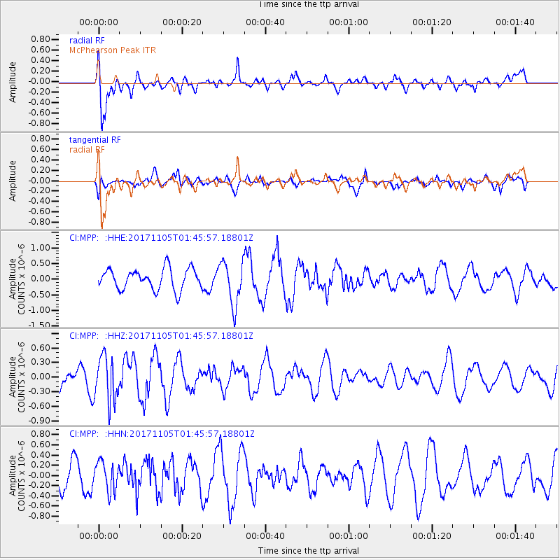
MPP McPhearson Peak - Earthquake Result Viewer
*The percent match for this event was below the threshold and hence no stack was calculated.
| Earthquake location: |
Fiji Islands Region |
| Earthquake latitude/longitude: |
-18.6/-177.7 |
| Earthquake time(UTC): |
2017/11/05 (309) 01:35:28 GMT |
| Earthquake Depth: |
483 km |
| Earthquake Magnitude: |
5.5 Mww |
| Earthquake Catalog/Contributor: |
NEIC PDE/us |
|
| Network: |
CI Caltech Regional Seismic Network |
| Station: |
MPP McPhearson Peak |
| Lat/Lon: |
34.89 N/119.81 W |
| Elevation: |
1739 m |
|
| Distance: |
76.5 deg |
| Az: |
45.751 deg |
| Baz: |
235.707 deg |
| Ray Param: |
$rayparam |
*The percent match for this event was below the threshold and hence was not used in the summary stack. |
|
| Radial Match: |
71.282646 % |
| Radial Bump: |
400 |
| Transverse Match: |
49.243668 % |
| Transverse Bump: |
400 |
| SOD ConfigId: |
13570011 |
| Insert Time: |
2019-04-29 03:14:31.870 +0000 |
| GWidth: |
2.5 |
| Max Bumps: |
400 |
| Tol: |
0.001 |
|
Signal To Noise
| Channel | StoN | STA | LTA |
| CI:MPP: :HHZ:20171105T01:45:57.18801Z | 2.056629 | 4.5523203E-7 | 2.2134866E-7 |
| CI:MPP: :HHN:20171105T01:45:57.18801Z | 0.7873867 | 2.8944913E-7 | 3.6760736E-7 |
| CI:MPP: :HHE:20171105T01:45:57.18801Z | 2.1601622 | 7.1658883E-7 | 3.3172915E-7 |
| Arrivals |
| Ps | |
| PpPs | |
| PsPs/PpSs | |


