You are here: Home > Network List > TA - USArray Transportable Network (new EarthScope stations) Stations List
> Station K13K Kusilvak Mountain, AK, USA > Earthquake Result Viewer
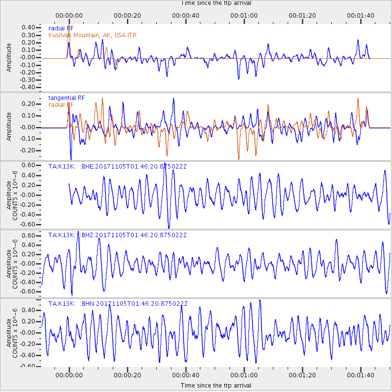
K13K Kusilvak Mountain, AK, USA - Earthquake Result Viewer
*The percent match for this event was below the threshold and hence no stack was calculated.
| Earthquake location: |
Fiji Islands Region |
| Earthquake latitude/longitude: |
-18.6/-177.7 |
| Earthquake time(UTC): |
2017/11/05 (309) 01:35:28 GMT |
| Earthquake Depth: |
483 km |
| Earthquake Magnitude: |
5.5 Mww |
| Earthquake Catalog/Contributor: |
NEIC PDE/us |
|
| Network: |
TA USArray Transportable Network (new EarthScope stations) |
| Station: |
K13K Kusilvak Mountain, AK, USA |
| Lat/Lon: |
61.93 N/164.66 W |
| Elevation: |
204 m |
|
| Distance: |
81.0 deg |
| Az: |
6.226 deg |
| Baz: |
192.557 deg |
| Ray Param: |
$rayparam |
*The percent match for this event was below the threshold and hence was not used in the summary stack. |
|
| Radial Match: |
44.666748 % |
| Radial Bump: |
353 |
| Transverse Match: |
52.018433 % |
| Transverse Bump: |
400 |
| SOD ConfigId: |
13570011 |
| Insert Time: |
2019-04-29 03:17:28.364 +0000 |
| GWidth: |
2.5 |
| Max Bumps: |
400 |
| Tol: |
0.001 |
|
Signal To Noise
| Channel | StoN | STA | LTA |
| TA:K13K: :BHZ:20171105T01:46:20.875022Z | 1.1788362 | 3.2976396E-7 | 2.7973687E-7 |
| TA:K13K: :BHN:20171105T01:46:20.875022Z | 0.7354265 | 1.4255181E-7 | 1.9383556E-7 |
| TA:K13K: :BHE:20171105T01:46:20.875022Z | 2.233862 | 3.751534E-7 | 1.6793939E-7 |
| Arrivals |
| Ps | |
| PpPs | |
| PsPs/PpSs | |


