You are here: Home > Network List > TA - USArray Transportable Network (new EarthScope stations) Stations List
> Station G21K Allakaket, AK, USA > Earthquake Result Viewer
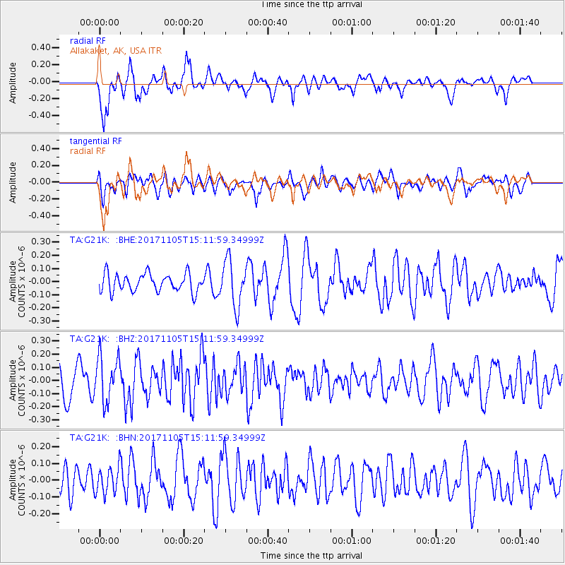
G21K Allakaket, AK, USA - Earthquake Result Viewer
*The percent match for this event was below the threshold and hence no stack was calculated.
| Earthquake location: |
Windward Islands |
| Earthquake latitude/longitude: |
11.7/-61.2 |
| Earthquake time(UTC): |
2017/11/05 (309) 15:00:24 GMT |
| Earthquake Depth: |
47 km |
| Earthquake Magnitude: |
5.5 Mww |
| Earthquake Catalog/Contributor: |
NEIC PDE/us |
|
| Network: |
TA USArray Transportable Network (new EarthScope stations) |
| Station: |
G21K Allakaket, AK, USA |
| Lat/Lon: |
66.52 N/153.51 W |
| Elevation: |
446 m |
|
| Distance: |
80.3 deg |
| Az: |
336.033 deg |
| Baz: |
83.183 deg |
| Ray Param: |
$rayparam |
*The percent match for this event was below the threshold and hence was not used in the summary stack. |
|
| Radial Match: |
63.751923 % |
| Radial Bump: |
400 |
| Transverse Match: |
56.876793 % |
| Transverse Bump: |
400 |
| SOD ConfigId: |
13570011 |
| Insert Time: |
2019-04-29 03:25:27.694 +0000 |
| GWidth: |
2.5 |
| Max Bumps: |
400 |
| Tol: |
0.001 |
|
Signal To Noise
| Channel | StoN | STA | LTA |
| TA:G21K: :BHZ:20171105T15:11:59.34999Z | 1.8580707 | 1.7465267E-7 | 9.399678E-8 |
| TA:G21K: :BHN:20171105T15:11:59.34999Z | 1.0380594 | 7.7858154E-8 | 7.500357E-8 |
| TA:G21K: :BHE:20171105T15:11:59.34999Z | 2.6317503 | 1.7921117E-7 | 6.809581E-8 |
| Arrivals |
| Ps | |
| PpPs | |
| PsPs/PpSs | |


