You are here: Home > Network List > UW - Pacific Northwest Regional Seismic Network Stations List
> Station MRBL Marblemount, WA, USA > Earthquake Result Viewer
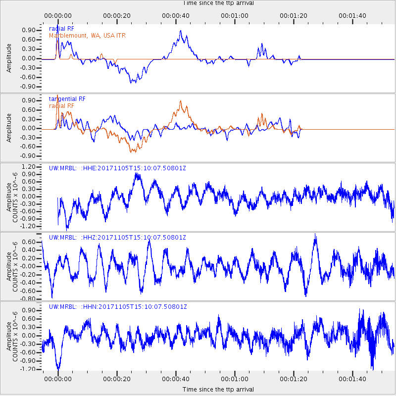
MRBL Marblemount, WA, USA - Earthquake Result Viewer
*The percent match for this event was below the threshold and hence no stack was calculated.
| Earthquake location: |
Windward Islands |
| Earthquake latitude/longitude: |
11.7/-61.2 |
| Earthquake time(UTC): |
2017/11/05 (309) 15:00:24 GMT |
| Earthquake Depth: |
47 km |
| Earthquake Magnitude: |
5.5 Mww |
| Earthquake Catalog/Contributor: |
NEIC PDE/us |
|
| Network: |
UW Pacific Northwest Regional Seismic Network |
| Station: |
MRBL Marblemount, WA, USA |
| Lat/Lon: |
48.52 N/121.48 W |
| Elevation: |
75 m |
|
| Distance: |
61.8 deg |
| Az: |
319.047 deg |
| Baz: |
105.051 deg |
| Ray Param: |
$rayparam |
*The percent match for this event was below the threshold and hence was not used in the summary stack. |
|
| Radial Match: |
41.567696 % |
| Radial Bump: |
400 |
| Transverse Match: |
66.23068 % |
| Transverse Bump: |
400 |
| SOD ConfigId: |
13570011 |
| Insert Time: |
2019-04-29 03:26:33.125 +0000 |
| GWidth: |
2.5 |
| Max Bumps: |
400 |
| Tol: |
0.001 |
|
Signal To Noise
| Channel | StoN | STA | LTA |
| UW:MRBL: :HHZ:20171105T15:10:07.50801Z | 0.5888392 | 1.6479248E-7 | 2.798599E-7 |
| UW:MRBL: :HHN:20171105T15:10:07.50801Z | 2.2255156 | 7.0028426E-7 | 3.1466155E-7 |
| UW:MRBL: :HHE:20171105T15:10:07.50801Z | 1.7486923 | 6.4997664E-7 | 3.7169298E-7 |
| Arrivals |
| Ps | |
| PpPs | |
| PsPs/PpSs | |


