You are here: Home > Network List > TA - USArray Transportable Network (new EarthScope stations) Stations List
> Station E18K Tukpahlearik Creek, AK, USA > Earthquake Result Viewer
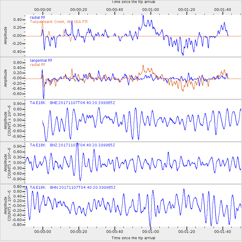
E18K Tukpahlearik Creek, AK, USA - Earthquake Result Viewer
*The percent match for this event was below the threshold and hence no stack was calculated.
| Earthquake location: |
Loyalty Islands |
| Earthquake latitude/longitude: |
-21.5/168.5 |
| Earthquake time(UTC): |
2017/11/07 (311) 04:27:45 GMT |
| Earthquake Depth: |
10 km |
| Earthquake Magnitude: |
5.5 Mww |
| Earthquake Catalog/Contributor: |
NEIC PDE/us |
|
| Network: |
TA USArray Transportable Network (new EarthScope stations) |
| Station: |
E18K Tukpahlearik Creek, AK, USA |
| Lat/Lon: |
67.42 N/160.60 W |
| Elevation: |
297 m |
|
| Distance: |
91.5 deg |
| Az: |
11.425 deg |
| Baz: |
208.543 deg |
| Ray Param: |
$rayparam |
*The percent match for this event was below the threshold and hence was not used in the summary stack. |
|
| Radial Match: |
46.706024 % |
| Radial Bump: |
400 |
| Transverse Match: |
62.98275 % |
| Transverse Bump: |
400 |
| SOD ConfigId: |
13570011 |
| Insert Time: |
2019-04-29 03:30:39.778 +0000 |
| GWidth: |
2.5 |
| Max Bumps: |
400 |
| Tol: |
0.001 |
|
Signal To Noise
| Channel | StoN | STA | LTA |
| TA:E18K: :BHZ:20171107T04:40:20.399985Z | 0.8904005 | 3.207148E-7 | 3.6019162E-7 |
| TA:E18K: :BHN:20171107T04:40:20.399985Z | 1.0266666 | 4.0701107E-7 | 3.9643936E-7 |
| TA:E18K: :BHE:20171107T04:40:20.399985Z | 0.9510449 | 4.247623E-7 | 4.4662698E-7 |
| Arrivals |
| Ps | |
| PpPs | |
| PsPs/PpSs | |


