You are here: Home > Network List > TA - USArray Transportable Network (new EarthScope stations) Stations List
> Station P18A Preston Nutter Ranch, Sunnyside, UT, USA > Earthquake Result Viewer
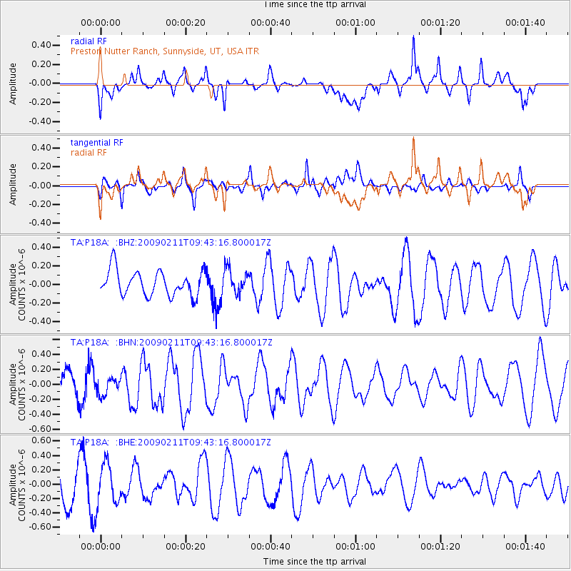
P18A Preston Nutter Ranch, Sunnyside, UT, USA - Earthquake Result Viewer
*The percent match for this event was below the threshold and hence no stack was calculated.
| Earthquake location: |
Fiji Islands Region |
| Earthquake latitude/longitude: |
-20.8/-177.3 |
| Earthquake time(UTC): |
2009/02/11 (042) 09:31:04 GMT |
| Earthquake Depth: |
10 km |
| Earthquake Magnitude: |
5.5 MB, 5.2 MS, 5.5 MW, 5.5 MW |
| Earthquake Catalog/Contributor: |
WHDF/NEIC |
|
| Network: |
TA USArray Transportable Network (new EarthScope stations) |
| Station: |
P18A Preston Nutter Ranch, Sunnyside, UT, USA |
| Lat/Lon: |
39.63 N/110.25 W |
| Elevation: |
2743 m |
|
| Distance: |
86.7 deg |
| Az: |
45.428 deg |
| Baz: |
239.672 deg |
| Ray Param: |
$rayparam |
*The percent match for this event was below the threshold and hence was not used in the summary stack. |
|
| Radial Match: |
59.53954 % |
| Radial Bump: |
400 |
| Transverse Match: |
45.929165 % |
| Transverse Bump: |
400 |
| SOD ConfigId: |
2658 |
| Insert Time: |
2010-03-06 06:04:45.594 +0000 |
| GWidth: |
2.5 |
| Max Bumps: |
400 |
| Tol: |
0.001 |
|
Signal To Noise
| Channel | StoN | STA | LTA |
| TA:P18A: :BHN:20090211T09:43:16.800017Z | 0.57718694 | 1.1246881E-7 | 1.9485681E-7 |
| TA:P18A: :BHE:20090211T09:43:16.800017Z | 0.81867063 | 2.7042555E-7 | 3.3032276E-7 |
| TA:P18A: :BHZ:20090211T09:43:16.800017Z | 0.9714653 | 1.3110106E-7 | 1.3495188E-7 |
| Arrivals |
| Ps | |
| PpPs | |
| PsPs/PpSs | |


