You are here: Home > Network List > TA - USArray Transportable Network (new EarthScope stations) Stations List
> Station P18A Preston Nutter Ranch, Sunnyside, UT, USA > Earthquake Result Viewer
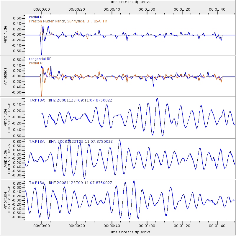
P18A Preston Nutter Ranch, Sunnyside, UT, USA - Earthquake Result Viewer
*The percent match for this event was below the threshold and hence no stack was calculated.
| Earthquake location: |
Southeast Of Loyalty Islands |
| Earthquake latitude/longitude: |
-22.4/171.3 |
| Earthquake time(UTC): |
2008/11/23 (328) 08:58:18 GMT |
| Earthquake Depth: |
40 km |
| Earthquake Magnitude: |
5.6 MW, 5.3 MS, 5.3 MB, 5.5 MW |
| Earthquake Catalog/Contributor: |
WHDF/NEIC |
|
| Network: |
TA USArray Transportable Network (new EarthScope stations) |
| Station: |
P18A Preston Nutter Ranch, Sunnyside, UT, USA |
| Lat/Lon: |
39.63 N/110.25 W |
| Elevation: |
2743 m |
|
| Distance: |
95.6 deg |
| Az: |
49.487 deg |
| Baz: |
245.615 deg |
| Ray Param: |
$rayparam |
*The percent match for this event was below the threshold and hence was not used in the summary stack. |
|
| Radial Match: |
54.334774 % |
| Radial Bump: |
400 |
| Transverse Match: |
57.3889 % |
| Transverse Bump: |
400 |
| SOD ConfigId: |
2658 |
| Insert Time: |
2010-03-06 06:05:53.026 +0000 |
| GWidth: |
2.5 |
| Max Bumps: |
400 |
| Tol: |
0.001 |
|
Signal To Noise
| Channel | StoN | STA | LTA |
| TA:P18A: :BHN:20081123T09:11:07.875002Z | 0.5441005 | 1.1809903E-7 | 2.1705371E-7 |
| TA:P18A: :BHE:20081123T09:11:07.875002Z | 2.4721966 | 5.8065905E-7 | 2.3487576E-7 |
| TA:P18A: :BHZ:20081123T09:11:07.875002Z | 1.9302331 | 2.2310992E-7 | 1.1558703E-7 |
| Arrivals |
| Ps | |
| PpPs | |
| PsPs/PpSs | |


