You are here: Home > Network List > UW - Pacific Northwest Regional Seismic Network Stations List
> Station UMAT Pilot Rock, OR, USA > Earthquake Result Viewer
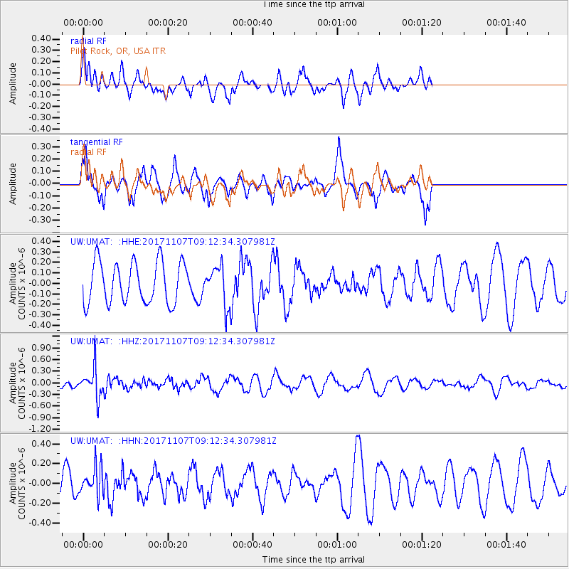
UMAT Pilot Rock, OR, USA - Earthquake Result Viewer
*The percent match for this event was below the threshold and hence no stack was calculated.
| Earthquake location: |
Fiji Islands Region |
| Earthquake latitude/longitude: |
-17.7/-178.5 |
| Earthquake time(UTC): |
2017/11/07 (311) 09:01:39 GMT |
| Earthquake Depth: |
555 km |
| Earthquake Magnitude: |
5.7 Mww |
| Earthquake Catalog/Contributor: |
NEIC PDE/us |
|
| Network: |
UW Pacific Northwest Regional Seismic Network |
| Station: |
UMAT Pilot Rock, OR, USA |
| Lat/Lon: |
45.29 N/118.96 W |
| Elevation: |
1318 m |
|
| Distance: |
82.7 deg |
| Az: |
37.856 deg |
| Baz: |
235.977 deg |
| Ray Param: |
$rayparam |
*The percent match for this event was below the threshold and hence was not used in the summary stack. |
|
| Radial Match: |
46.719673 % |
| Radial Bump: |
382 |
| Transverse Match: |
70.80394 % |
| Transverse Bump: |
330 |
| SOD ConfigId: |
13570011 |
| Insert Time: |
2019-04-29 03:38:13.891 +0000 |
| GWidth: |
2.5 |
| Max Bumps: |
400 |
| Tol: |
0.001 |
|
Signal To Noise
| Channel | StoN | STA | LTA |
| UW:UMAT: :HHZ:20171107T09:12:34.307981Z | 3.2425687 | 3.9492505E-7 | 1.2179389E-7 |
| UW:UMAT: :HHN:20171107T09:12:34.307981Z | 0.8710094 | 1.4699789E-7 | 1.6876729E-7 |
| UW:UMAT: :HHE:20171107T09:12:34.307981Z | 0.96764517 | 1.904948E-7 | 1.968643E-7 |
| Arrivals |
| Ps | |
| PpPs | |
| PsPs/PpSs | |


