You are here: Home > Network List > TA - USArray Transportable Network (new EarthScope stations) Stations List
> Station P18A Preston Nutter Ranch, Sunnyside, UT, USA > Earthquake Result Viewer
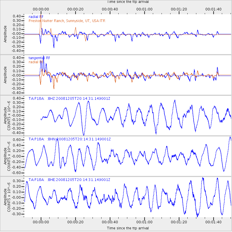
P18A Preston Nutter Ranch, Sunnyside, UT, USA - Earthquake Result Viewer
*The percent match for this event was below the threshold and hence no stack was calculated.
| Earthquake location: |
Off East Coast Of Honshu, Japan |
| Earthquake latitude/longitude: |
38.5/143.0 |
| Earthquake time(UTC): |
2008/12/05 (340) 20:03:11 GMT |
| Earthquake Depth: |
34 km |
| Earthquake Magnitude: |
5.5 MW, 5.2 MS, 5.2 MB, 5.5 MW |
| Earthquake Catalog/Contributor: |
WHDF/NEIC |
|
| Network: |
TA USArray Transportable Network (new EarthScope stations) |
| Station: |
P18A Preston Nutter Ranch, Sunnyside, UT, USA |
| Lat/Lon: |
39.63 N/110.25 W |
| Elevation: |
2743 m |
|
| Distance: |
77.3 deg |
| Az: |
49.289 deg |
| Baz: |
309.663 deg |
| Ray Param: |
$rayparam |
*The percent match for this event was below the threshold and hence was not used in the summary stack. |
|
| Radial Match: |
52.225597 % |
| Radial Bump: |
380 |
| Transverse Match: |
80.328156 % |
| Transverse Bump: |
400 |
| SOD ConfigId: |
2658 |
| Insert Time: |
2010-03-06 06:06:01.203 +0000 |
| GWidth: |
2.5 |
| Max Bumps: |
400 |
| Tol: |
0.001 |
|
Signal To Noise
| Channel | StoN | STA | LTA |
| TA:P18A: :BHN:20081205T20:14:31.149001Z | 1.336651 | 2.3809451E-7 | 1.7812766E-7 |
| TA:P18A: :BHE:20081205T20:14:31.149001Z | 0.764203 | 1.1672389E-7 | 1.5273937E-7 |
| TA:P18A: :BHZ:20081205T20:14:31.149001Z | 0.8197729 | 1.2082985E-7 | 1.4739429E-7 |
| Arrivals |
| Ps | |
| PpPs | |
| PsPs/PpSs | |


