BBR Big Bear Solar Observatory - Earthquake Result Viewer
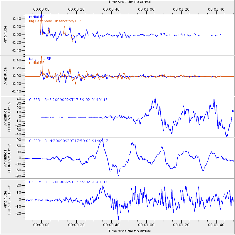
Earthquake location: Samoa Islands Region
Earthquake latitude/longitude: -15.5/-172.1
Earthquake time(UTC): 2009/09/29 (272) 17:48:10 GMT
Earthquake Depth: 18 km
Earthquake Magnitude: 7.1 MB, 8.1 MS, 8.1 MW, 8.0 MW
Earthquake Catalog/Contributor: WHDF/NEIC
Network: CI Caltech Regional Seismic Network
Station: BBR Big Bear Solar Observatory
Lat/Lon: 34.26 N/116.92 W
Elevation: 2069 m
Distance: 72.1 deg
Az: 45.598 deg
Baz: 236.274 deg
Ray Param: 0.053867497
Estimated Moho Depth: 40.5 km
Estimated Crust Vp/Vs: 1.64
Assumed Crust Vp: 6.276 km/s
Estimated Crust Vs: 3.827 km/s
Estimated Crust Poisson's Ratio: 0.20
Radial Match: 97.27804 %
Radial Bump: 400
Transverse Match: 90.67772 %
Transverse Bump: 400
SOD ConfigId: 2622
Insert Time: 2010-02-26 01:36:48.369 +0000
GWidth: 2.5
Max Bumps: 400
Tol: 0.001

Signal To Noise

ChannelStoNSTALTA
CI:BBR: :BHN:20090929T17:59:02.914011Z9.18022252.599689E-62.8318368E-7
CI:BBR: :BHE:20090929T17:59:02.914011Z1.59276696.1304263E-73.848916E-7
CI:BBR: :BHZ:20090929T17:59:02.914011Z2.69351057.18903E-72.6690188E-7
Arrivals
Ps4.3 SECOND
PpPs16 SECOND
PsPs/PpSs21 SECOND