You are here: Home > Network List > CI - Caltech Regional Seismic Network Stations List
> Station MPP McPhearson Peak > Earthquake Result Viewer
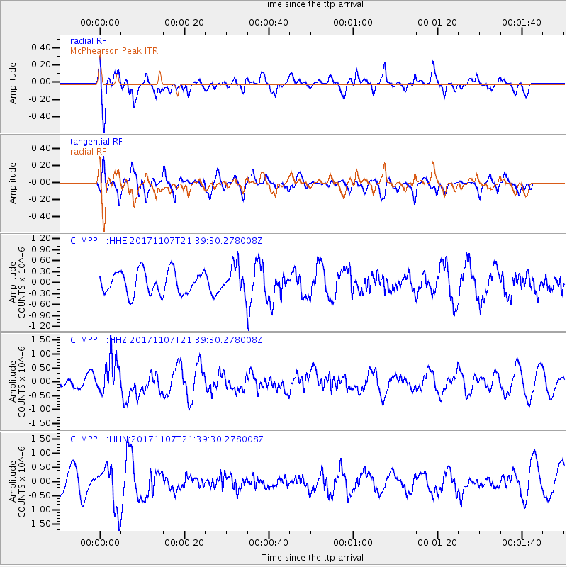
MPP McPhearson Peak - Earthquake Result Viewer
*The percent match for this event was below the threshold and hence no stack was calculated.
| Earthquake location: |
New Guinea, Papua New Guinea |
| Earthquake latitude/longitude: |
-4.2/143.5 |
| Earthquake time(UTC): |
2017/11/07 (311) 21:26:38 GMT |
| Earthquake Depth: |
107 km |
| Earthquake Magnitude: |
6.5 mww |
| Earthquake Catalog/Contributor: |
NEIC PDE/us |
|
| Network: |
CI Caltech Regional Seismic Network |
| Station: |
MPP McPhearson Peak |
| Lat/Lon: |
34.89 N/119.81 W |
| Elevation: |
1739 m |
|
| Distance: |
97.9 deg |
| Az: |
55.514 deg |
| Baz: |
270.354 deg |
| Ray Param: |
$rayparam |
*The percent match for this event was below the threshold and hence was not used in the summary stack. |
|
| Radial Match: |
59.383152 % |
| Radial Bump: |
400 |
| Transverse Match: |
60.50658 % |
| Transverse Bump: |
400 |
| SOD ConfigId: |
13570011 |
| Insert Time: |
2019-04-29 03:41:24.082 +0000 |
| GWidth: |
2.5 |
| Max Bumps: |
400 |
| Tol: |
0.001 |
|
Signal To Noise
| Channel | StoN | STA | LTA |
| CI:MPP: :HHZ:20171107T21:39:30.278008Z | 2.4695556 | 6.505578E-7 | 2.6343113E-7 |
| CI:MPP: :HHN:20171107T21:39:30.278008Z | 2.947321 | 7.760812E-7 | 2.6331753E-7 |
| CI:MPP: :HHE:20171107T21:39:30.278008Z | 1.2576919 | 3.8775985E-7 | 3.083107E-7 |
| Arrivals |
| Ps | |
| PpPs | |
| PsPs/PpSs | |


