You are here: Home > Network List > TA - USArray Transportable Network (new EarthScope stations) Stations List
> Station P17K Kvichak River, AK, USA > Earthquake Result Viewer
P17K Kvichak River, AK, USA - Earthquake Result Viewer
*The percent match for this event was below the threshold and hence no stack was calculated.
| Earthquake location: |
New Guinea, Papua New Guinea |
| Earthquake latitude/longitude: |
-4.2/143.5 |
| Earthquake time(UTC): |
2017/11/07 (311) 21:26:38 GMT |
| Earthquake Depth: |
107 km |
| Earthquake Magnitude: |
6.5 mww |
| Earthquake Catalog/Contributor: |
NEIC PDE/us |
|
| Network: |
TA USArray Transportable Network (new EarthScope stations) |
| Station: |
P17K Kvichak River, AK, USA |
| Lat/Lon: |
59.20 N/156.44 W |
| Elevation: |
91 m |
|
| Distance: |
78.9 deg |
| Az: |
27.041 deg |
| Baz: |
241.764 deg |
| Ray Param: |
$rayparam |
*The percent match for this event was below the threshold and hence was not used in the summary stack. |
|
| Radial Match: |
68.18839 % |
| Radial Bump: |
400 |
| Transverse Match: |
62.324886 % |
| Transverse Bump: |
400 |
| SOD ConfigId: |
13570011 |
| Insert Time: |
2019-04-29 03:45:17.861 +0000 |
| GWidth: |
2.5 |
| Max Bumps: |
400 |
| Tol: |
0.001 |
|
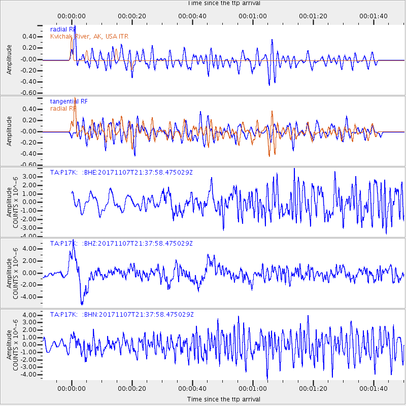
Signal To Noise
| Channel | StoN | STA | LTA |
| TA:P17K: :BHZ:20171107T21:37:58.475029Z | 5.7633276 | 3.304726E-6 | 5.7340594E-7 |
| TA:P17K: :BHN:20171107T21:37:58.475029Z | 1.7812746 | 1.0841529E-6 | 6.0863886E-7 |
| TA:P17K: :BHE:20171107T21:37:58.475029Z | 1.3849794 | 1.0670406E-6 | 7.704379E-7 |
| Arrivals |
| Ps | |
| PpPs | |
| PsPs/PpSs | |


