You are here: Home > Network List > TA - USArray Transportable Network (new EarthScope stations) Stations List
> Station R31K City Hall, Gustavus, AK, USA > Earthquake Result Viewer
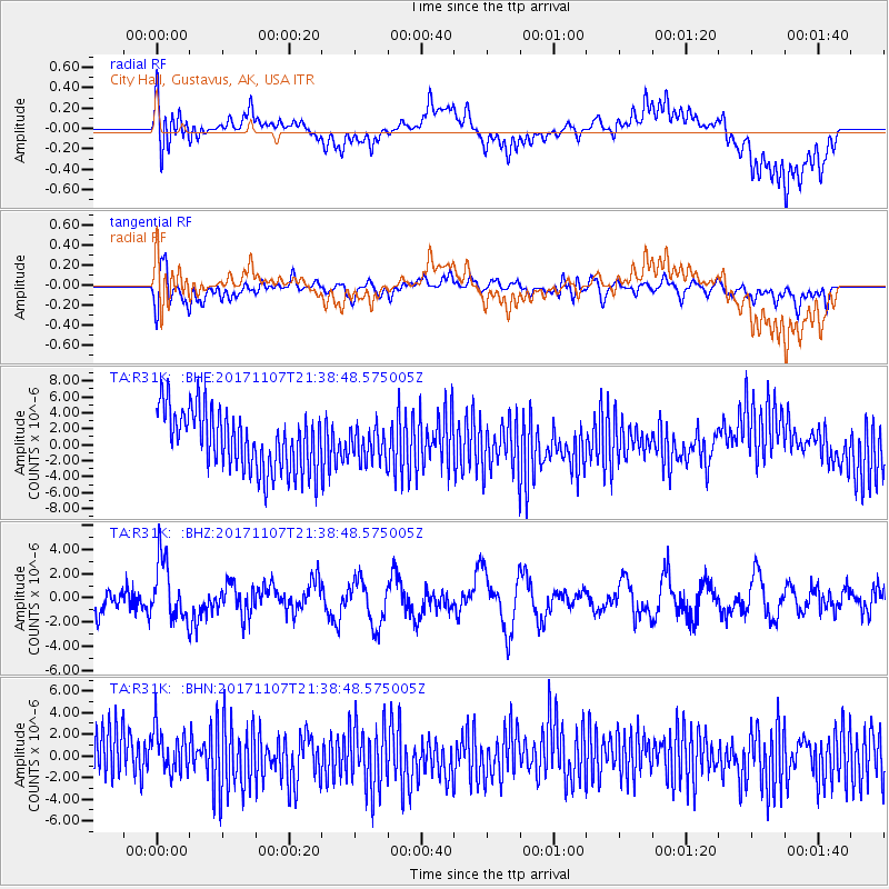
R31K City Hall, Gustavus, AK, USA - Earthquake Result Viewer
*The percent match for this event was below the threshold and hence no stack was calculated.
| Earthquake location: |
New Guinea, Papua New Guinea |
| Earthquake latitude/longitude: |
-4.2/143.5 |
| Earthquake time(UTC): |
2017/11/07 (311) 21:26:38 GMT |
| Earthquake Depth: |
107 km |
| Earthquake Magnitude: |
6.5 mww |
| Earthquake Catalog/Contributor: |
NEIC PDE/us |
|
| Network: |
TA USArray Transportable Network (new EarthScope stations) |
| Station: |
R31K City Hall, Gustavus, AK, USA |
| Lat/Lon: |
58.41 N/135.74 W |
| Elevation: |
15 m |
|
| Distance: |
88.7 deg |
| Az: |
31.31 deg |
| Baz: |
259.954 deg |
| Ray Param: |
$rayparam |
*The percent match for this event was below the threshold and hence was not used in the summary stack. |
|
| Radial Match: |
34.73703 % |
| Radial Bump: |
400 |
| Transverse Match: |
45.929707 % |
| Transverse Bump: |
400 |
| SOD ConfigId: |
13570011 |
| Insert Time: |
2019-04-29 03:45:30.929 +0000 |
| GWidth: |
2.5 |
| Max Bumps: |
400 |
| Tol: |
0.001 |
|
Signal To Noise
| Channel | StoN | STA | LTA |
| TA:R31K: :BHZ:20171107T21:38:48.575005Z | 3.0956047 | 2.4459712E-6 | 7.9014325E-7 |
| TA:R31K: :BHN:20171107T21:38:48.575005Z | 0.90351164 | 1.98038E-6 | 2.19187E-6 |
| TA:R31K: :BHE:20171107T21:38:48.575005Z | 0.53545076 | 2.013033E-6 | 3.759511E-6 |
| Arrivals |
| Ps | |
| PpPs | |
| PsPs/PpSs | |


