You are here: Home > Network List > TA - USArray Transportable Network (new EarthScope stations) Stations List
> Station F18A Big Timber, MT, USA > Earthquake Result Viewer
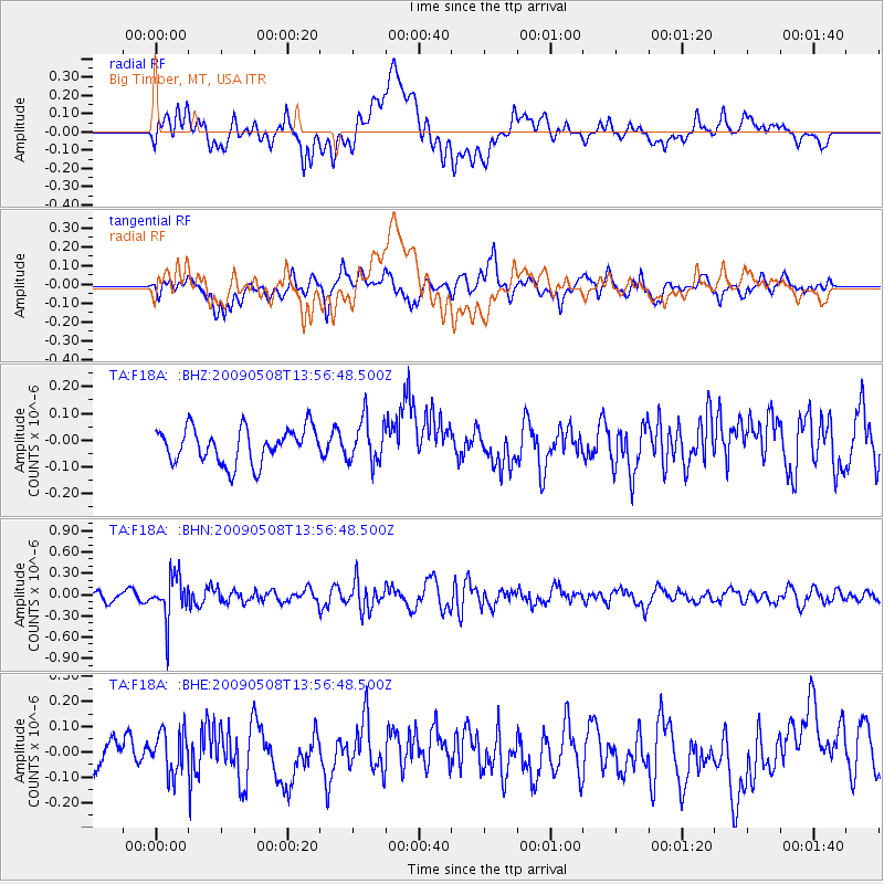
F18A Big Timber, MT, USA - Earthquake Result Viewer
*The percent match for this event was below the threshold and hence no stack was calculated.
| Earthquake location: |
Mendoza Province, Argentina |
| Earthquake latitude/longitude: |
-32.1/-69.7 |
| Earthquake time(UTC): |
2009/05/08 (128) 13:44:53 GMT |
| Earthquake Depth: |
112 km |
| Earthquake Magnitude: |
5.6 MB, 5.4 MW |
| Earthquake Catalog/Contributor: |
WHDF/NEIC |
|
| Network: |
TA USArray Transportable Network (new EarthScope stations) |
| Station: |
F18A Big Timber, MT, USA |
| Lat/Lon: |
45.90 N/109.72 W |
| Elevation: |
1291 m |
|
| Distance: |
85.7 deg |
| Az: |
333.225 deg |
| Baz: |
146.783 deg |
| Ray Param: |
$rayparam |
*The percent match for this event was below the threshold and hence was not used in the summary stack. |
|
| Radial Match: |
57.155376 % |
| Radial Bump: |
400 |
| Transverse Match: |
42.414593 % |
| Transverse Bump: |
400 |
| SOD ConfigId: |
2658 |
| Insert Time: |
2010-03-06 06:08:27.405 +0000 |
| GWidth: |
2.5 |
| Max Bumps: |
400 |
| Tol: |
0.001 |
|
Signal To Noise
| Channel | StoN | STA | LTA |
| TA:F18A: :BHN:20090508T13:56:48.500Z | 3.2029366 | 3.0550174E-7 | 9.5381765E-8 |
| TA:F18A: :BHE:20090508T13:56:48.500Z | 1.1822981 | 8.193281E-8 | 6.9299624E-8 |
| TA:F18A: :BHZ:20090508T13:56:48.500Z | 1.2492545 | 8.124572E-8 | 6.5035366E-8 |
| Arrivals |
| Ps | |
| PpPs | |
| PsPs/PpSs | |


