You are here: Home > Network List > CN - Canadian National Seismograph Network Stations List
> Station INK INUVIK, NT > Earthquake Result Viewer
INK INUVIK, NT - Earthquake Result Viewer
*The percent match for this event was below the threshold and hence no stack was calculated.
| Earthquake location: |
Fiji Islands Region |
| Earthquake latitude/longitude: |
-21.9/-179.4 |
| Earthquake time(UTC): |
2017/11/08 (312) 07:35:11 GMT |
| Earthquake Depth: |
583 km |
| Earthquake Magnitude: |
5.7 Mww |
| Earthquake Catalog/Contributor: |
NEIC PDE/us |
|
| Network: |
CN Canadian National Seismograph Network |
| Station: |
INK INUVIK, NT |
| Lat/Lon: |
68.31 N/133.53 W |
| Elevation: |
44 m |
|
| Distance: |
95.9 deg |
| Az: |
15.572 deg |
| Baz: |
222.123 deg |
| Ray Param: |
$rayparam |
*The percent match for this event was below the threshold and hence was not used in the summary stack. |
|
| Radial Match: |
56.411335 % |
| Radial Bump: |
400 |
| Transverse Match: |
59.288345 % |
| Transverse Bump: |
400 |
| SOD ConfigId: |
13570011 |
| Insert Time: |
2019-04-29 03:49:05.239 +0000 |
| GWidth: |
2.5 |
| Max Bumps: |
400 |
| Tol: |
0.001 |
|
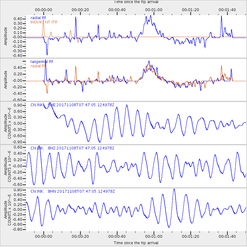
Signal To Noise
| Channel | StoN | STA | LTA |
| CN:INK: :BHZ:20171108T07:47:05.124978Z | 0.9380103 | 3.3377236E-7 | 3.558302E-7 |
| CN:INK: :BHN:20171108T07:47:05.124978Z | 1.8308338 | 3.526729E-7 | 1.9262967E-7 |
| CN:INK: :BHE:20171108T07:47:05.124978Z | 1.4237041 | 6.8407036E-7 | 4.8048634E-7 |
| Arrivals |
| Ps | |
| PpPs | |
| PsPs/PpSs | |


