You are here: Home > Network List > TA - USArray Transportable Network (new EarthScope stations) Stations List
> Station R31K City Hall, Gustavus, AK, USA > Earthquake Result Viewer
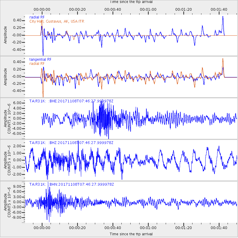
R31K City Hall, Gustavus, AK, USA - Earthquake Result Viewer
*The percent match for this event was below the threshold and hence no stack was calculated.
| Earthquake location: |
Fiji Islands Region |
| Earthquake latitude/longitude: |
-21.9/-179.4 |
| Earthquake time(UTC): |
2017/11/08 (312) 07:35:11 GMT |
| Earthquake Depth: |
583 km |
| Earthquake Magnitude: |
5.7 Mww |
| Earthquake Catalog/Contributor: |
NEIC PDE/us |
|
| Network: |
TA USArray Transportable Network (new EarthScope stations) |
| Station: |
R31K City Hall, Gustavus, AK, USA |
| Lat/Lon: |
58.41 N/135.74 W |
| Elevation: |
15 m |
|
| Distance: |
87.8 deg |
| Az: |
21.336 deg |
| Baz: |
219.952 deg |
| Ray Param: |
$rayparam |
*The percent match for this event was below the threshold and hence was not used in the summary stack. |
|
| Radial Match: |
44.04842 % |
| Radial Bump: |
400 |
| Transverse Match: |
41.571743 % |
| Transverse Bump: |
400 |
| SOD ConfigId: |
13570011 |
| Insert Time: |
2019-04-29 03:51:19.210 +0000 |
| GWidth: |
2.5 |
| Max Bumps: |
400 |
| Tol: |
0.001 |
|
Signal To Noise
| Channel | StoN | STA | LTA |
| TA:R31K: :BHZ:20171108T07:46:27.999978Z | 1.6272973 | 1.0213216E-6 | 6.276183E-7 |
| TA:R31K: :BHN:20171108T07:46:27.999978Z | 4.1441126 | 4.1698686E-6 | 1.006215E-6 |
| TA:R31K: :BHE:20171108T07:46:27.999978Z | 2.2824054 | 3.2554085E-6 | 1.4263059E-6 |
| Arrivals |
| Ps | |
| PpPs | |
| PsPs/PpSs | |


