You are here: Home > Network List > UW - Pacific Northwest Regional Seismic Network Stations List
> Station MRBL Marblemount, WA, USA > Earthquake Result Viewer
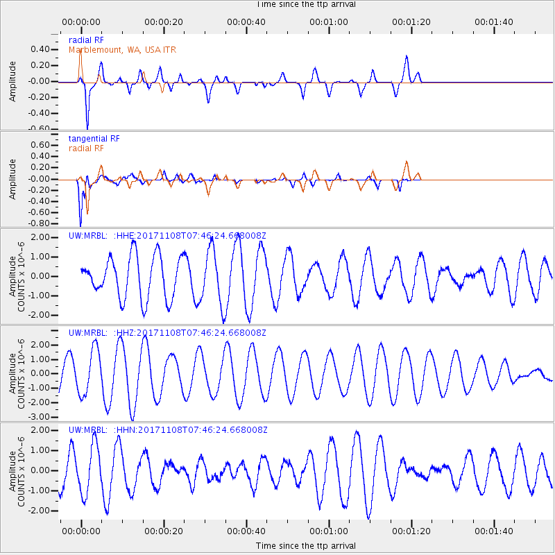
MRBL Marblemount, WA, USA - Earthquake Result Viewer
*The percent match for this event was below the threshold and hence no stack was calculated.
| Earthquake location: |
Fiji Islands Region |
| Earthquake latitude/longitude: |
-21.9/-179.4 |
| Earthquake time(UTC): |
2017/11/08 (312) 07:35:11 GMT |
| Earthquake Depth: |
583 km |
| Earthquake Magnitude: |
5.7 Mww |
| Earthquake Catalog/Contributor: |
NEIC PDE/us |
|
| Network: |
UW Pacific Northwest Regional Seismic Network |
| Station: |
MRBL Marblemount, WA, USA |
| Lat/Lon: |
48.52 N/121.48 W |
| Elevation: |
75 m |
|
| Distance: |
87.1 deg |
| Az: |
34.35 deg |
| Baz: |
232.031 deg |
| Ray Param: |
$rayparam |
*The percent match for this event was below the threshold and hence was not used in the summary stack. |
|
| Radial Match: |
70.579895 % |
| Radial Bump: |
400 |
| Transverse Match: |
67.79857 % |
| Transverse Bump: |
400 |
| SOD ConfigId: |
13570011 |
| Insert Time: |
2019-04-29 03:52:07.935 +0000 |
| GWidth: |
2.5 |
| Max Bumps: |
400 |
| Tol: |
0.001 |
|
Signal To Noise
| Channel | StoN | STA | LTA |
| UW:MRBL: :HHZ:20171108T07:46:24.668008Z | 2.4213502 | 1.5952326E-6 | 6.588194E-7 |
| UW:MRBL: :HHN:20171108T07:46:24.668008Z | 1.7622796 | 1.201523E-6 | 6.8180043E-7 |
| UW:MRBL: :HHE:20171108T07:46:24.668008Z | 1.3313534 | 1.4091661E-6 | 1.0584463E-6 |
| Arrivals |
| Ps | |
| PpPs | |
| PsPs/PpSs | |


