You are here: Home > Network List > TA - USArray Transportable Network (new EarthScope stations) Stations List
> Station F18A Big Timber, MT, USA > Earthquake Result Viewer
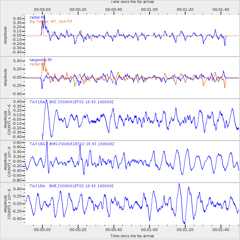
F18A Big Timber, MT, USA - Earthquake Result Viewer
*The percent match for this event was below the threshold and hence no stack was calculated.
| Earthquake location: |
Kermadec Islands Region |
| Earthquake latitude/longitude: |
-28.9/-177.4 |
| Earthquake time(UTC): |
2009/04/18 (108) 02:03:52 GMT |
| Earthquake Depth: |
65 km |
| Earthquake Magnitude: |
6.0 MB, 5.8 MW, 5.7 MW |
| Earthquake Catalog/Contributor: |
WHDF/NEIC |
|
| Network: |
TA USArray Transportable Network (new EarthScope stations) |
| Station: |
F18A Big Timber, MT, USA |
| Lat/Lon: |
45.90 N/109.72 W |
| Elevation: |
1291 m |
|
| Distance: |
96.4 deg |
| Az: |
40.563 deg |
| Baz: |
234.733 deg |
| Ray Param: |
$rayparam |
*The percent match for this event was below the threshold and hence was not used in the summary stack. |
|
| Radial Match: |
60.675922 % |
| Radial Bump: |
372 |
| Transverse Match: |
48.115326 % |
| Transverse Bump: |
400 |
| SOD ConfigId: |
2658 |
| Insert Time: |
2010-03-06 06:09:48.942 +0000 |
| GWidth: |
2.5 |
| Max Bumps: |
400 |
| Tol: |
0.001 |
|
Signal To Noise
| Channel | StoN | STA | LTA |
| TA:F18A: :BHN:20090418T02:16:43.149009Z | 1.9077635 | 3.2493202E-7 | 1.703209E-7 |
| TA:F18A: :BHE:20090418T02:16:43.149009Z | 0.37938616 | 6.971009E-8 | 1.8374442E-7 |
| TA:F18A: :BHZ:20090418T02:16:43.149009Z | 0.3880264 | 6.815105E-8 | 1.7563511E-7 |
| Arrivals |
| Ps | |
| PpPs | |
| PsPs/PpSs | |


