You are here: Home > Network List > TA - USArray Transportable Network (new EarthScope stations) Stations List
> Station F18A Big Timber, MT, USA > Earthquake Result Viewer
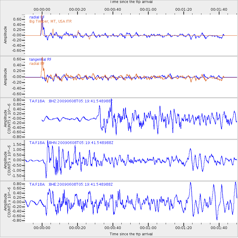
F18A Big Timber, MT, USA - Earthquake Result Viewer
*The percent match for this event was below the threshold and hence no stack was calculated.
| Earthquake location: |
Honduras |
| Earthquake latitude/longitude: |
15.8/-86.9 |
| Earthquake time(UTC): |
2009/06/08 (159) 05:13:14 GMT |
| Earthquake Depth: |
10 km |
| Earthquake Magnitude: |
5.5 MB, 4.9 MS, 5.4 MW, 5.4 MW |
| Earthquake Catalog/Contributor: |
WHDF/NEIC |
|
| Network: |
TA USArray Transportable Network (new EarthScope stations) |
| Station: |
F18A Big Timber, MT, USA |
| Lat/Lon: |
45.90 N/109.72 W |
| Elevation: |
1291 m |
|
| Distance: |
35.6 deg |
| Az: |
332.238 deg |
| Baz: |
140.043 deg |
| Ray Param: |
$rayparam |
*The percent match for this event was below the threshold and hence was not used in the summary stack. |
|
| Radial Match: |
78.715744 % |
| Radial Bump: |
400 |
| Transverse Match: |
62.517273 % |
| Transverse Bump: |
400 |
| SOD ConfigId: |
2648 |
| Insert Time: |
2010-03-06 06:09:57.256 +0000 |
| GWidth: |
2.5 |
| Max Bumps: |
400 |
| Tol: |
0.001 |
|
Signal To Noise
| Channel | StoN | STA | LTA |
| TA:F18A: :BHN:20090608T05:19:41.548988Z | 13.762017 | 7.9929424E-7 | 5.807973E-8 |
| TA:F18A: :BHE:20090608T05:19:41.548988Z | 5.2106323 | 3.1340198E-7 | 6.014663E-8 |
| TA:F18A: :BHZ:20090608T05:19:41.548988Z | 5.8334484 | 2.8300724E-7 | 4.851457E-8 |
| Arrivals |
| Ps | |
| PpPs | |
| PsPs/PpSs | |


