You are here: Home > Network List > TA - USArray Transportable Network (new EarthScope stations) Stations List
> Station F18A Big Timber, MT, USA > Earthquake Result Viewer
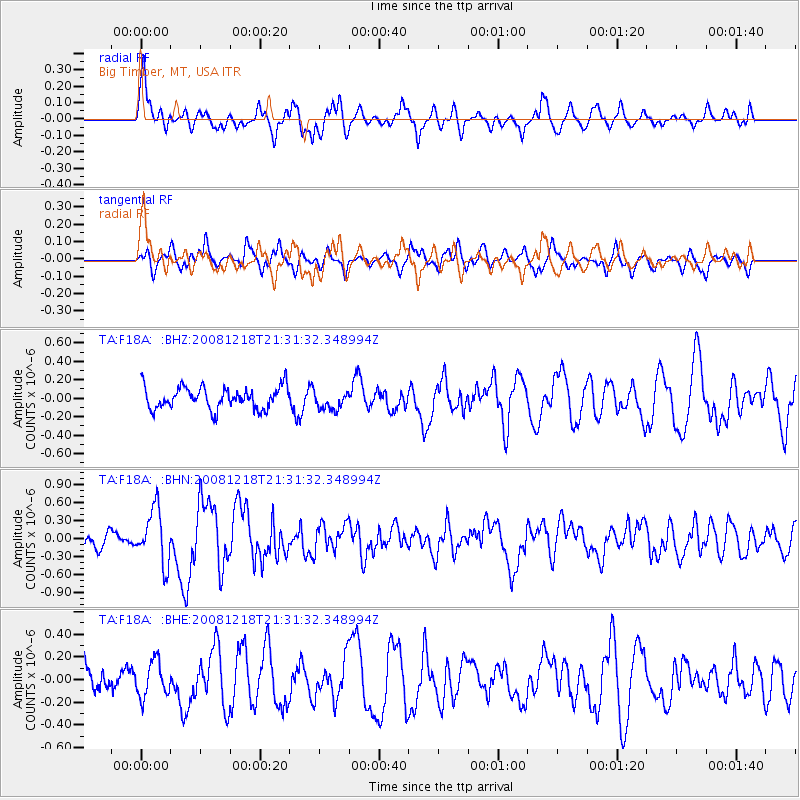
F18A Big Timber, MT, USA - Earthquake Result Viewer
*The percent match for this event was below the threshold and hence no stack was calculated.
| Earthquake location: |
Near Coast Of Central Chile |
| Earthquake latitude/longitude: |
-32.5/-71.7 |
| Earthquake time(UTC): |
2008/12/18 (353) 21:19:28 GMT |
| Earthquake Depth: |
18 km |
| Earthquake Magnitude: |
5.8 MB, 6.0 MS, 6.2 MW, 6.1 MW |
| Earthquake Catalog/Contributor: |
WHDF/NEIC |
|
| Network: |
TA USArray Transportable Network (new EarthScope stations) |
| Station: |
F18A Big Timber, MT, USA |
| Lat/Lon: |
45.90 N/109.72 W |
| Elevation: |
1291 m |
|
| Distance: |
85.2 deg |
| Az: |
334.451 deg |
| Baz: |
148.522 deg |
| Ray Param: |
$rayparam |
*The percent match for this event was below the threshold and hence was not used in the summary stack. |
|
| Radial Match: |
73.28812 % |
| Radial Bump: |
400 |
| Transverse Match: |
65.397736 % |
| Transverse Bump: |
400 |
| SOD ConfigId: |
2658 |
| Insert Time: |
2010-03-06 06:10:11.206 +0000 |
| GWidth: |
2.5 |
| Max Bumps: |
400 |
| Tol: |
0.001 |
|
Signal To Noise
| Channel | StoN | STA | LTA |
| TA:F18A: :BHN:20081218T21:31:32.348994Z | 3.118695 | 4.5187863E-7 | 1.448935E-7 |
| TA:F18A: :BHE:20081218T21:31:32.348994Z | 1.1890566 | 1.5589718E-7 | 1.3110997E-7 |
| TA:F18A: :BHZ:20081218T21:31:32.348994Z | 0.8621542 | 1.0196749E-7 | 1.1827059E-7 |
| Arrivals |
| Ps | |
| PpPs | |
| PsPs/PpSs | |


