You are here: Home > Network List > WY - Yellowstone Wyoming Seismic Network Stations List
> Station YHR Hawk's Rest, WY, USA > Earthquake Result Viewer
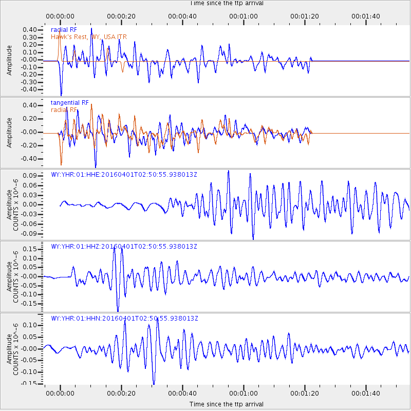
YHR Hawk's Rest, WY, USA - Earthquake Result Viewer
*The percent match for this event was below the threshold and hence no stack was calculated.
| Earthquake location: |
Near S. Coast Of Western Honshu |
| Earthquake latitude/longitude: |
33.4/136.4 |
| Earthquake time(UTC): |
2016/04/01 (092) 02:39:07 GMT |
| Earthquake Depth: |
10 km |
| Earthquake Magnitude: |
6.0 MWP |
| Earthquake Catalog/Contributor: |
NEIC PDE/NEIC COMCAT |
|
| Network: |
WY Yellowstone Wyoming Seismic Network |
| Station: |
YHR Hawk's Rest, WY, USA |
| Lat/Lon: |
44.11 N/110.08 W |
| Elevation: |
2976 m |
|
| Distance: |
82.0 deg |
| Az: |
41.845 deg |
| Baz: |
309.203 deg |
| Ray Param: |
$rayparam |
*The percent match for this event was below the threshold and hence was not used in the summary stack. |
|
| Radial Match: |
86.62136 % |
| Radial Bump: |
400 |
| Transverse Match: |
87.68344 % |
| Transverse Bump: |
400 |
| SOD ConfigId: |
1475611 |
| Insert Time: |
2016-04-15 03:25:12.070 +0000 |
| GWidth: |
2.5 |
| Max Bumps: |
400 |
| Tol: |
0.001 |
|
Signal To Noise
| Channel | StoN | STA | LTA |
| WY:YHR:01:HHZ:20160401T02:50:55.938013Z | 5.139779 | 1.9183053E-8 | 3.732272E-9 |
| WY:YHR:01:HHN:20160401T02:50:55.938013Z | 1.0386652 | 1.3255522E-8 | 1.2762074E-8 |
| WY:YHR:01:HHE:20160401T02:50:55.938013Z | 1.7908036 | 1.0146082E-8 | 5.665659E-9 |
| Arrivals |
| Ps | |
| PpPs | |
| PsPs/PpSs | |


