You are here: Home > Network List > TA - USArray Transportable Network (new EarthScope stations) Stations List
> Station F18A Big Timber, MT, USA > Earthquake Result Viewer
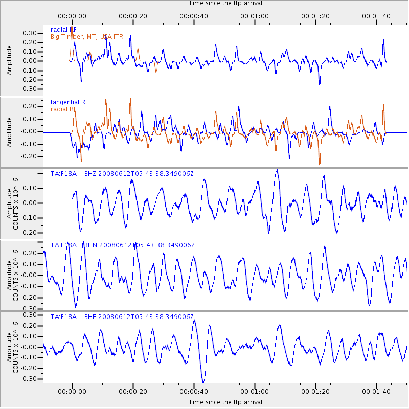
F18A Big Timber, MT, USA - Earthquake Result Viewer
*The percent match for this event was below the threshold and hence no stack was calculated.
| Earthquake location: |
Southern East Pacific Rise |
| Earthquake latitude/longitude: |
-50.2/-114.2 |
| Earthquake time(UTC): |
2008/06/12 (164) 05:30:43 GMT |
| Earthquake Depth: |
10 km |
| Earthquake Magnitude: |
5.6 MS, 5.3 MB, 5.9 MW, 5.9 MW |
| Earthquake Catalog/Contributor: |
WHDF/NEIC |
|
| Network: |
TA USArray Transportable Network (new EarthScope stations) |
| Station: |
F18A Big Timber, MT, USA |
| Lat/Lon: |
45.90 N/109.72 W |
| Elevation: |
1291 m |
|
| Distance: |
95.8 deg |
| Az: |
3.124 deg |
| Baz: |
182.877 deg |
| Ray Param: |
$rayparam |
*The percent match for this event was below the threshold and hence was not used in the summary stack. |
|
| Radial Match: |
64.03581 % |
| Radial Bump: |
400 |
| Transverse Match: |
41.77511 % |
| Transverse Bump: |
383 |
| SOD ConfigId: |
2504 |
| Insert Time: |
2010-03-06 06:10:43.441 +0000 |
| GWidth: |
2.5 |
| Max Bumps: |
400 |
| Tol: |
0.001 |
|
Signal To Noise
| Channel | StoN | STA | LTA |
| TA:F18A: :BHN:20080612T05:43:38.349006Z | 2.1399646 | 1.8572864E-7 | 8.679053E-8 |
| TA:F18A: :BHE:20080612T05:43:38.349006Z | 1.0516449 | 7.652309E-8 | 7.276514E-8 |
| TA:F18A: :BHZ:20080612T05:43:38.349006Z | 0.71727926 | 6.023357E-8 | 8.397506E-8 |
| Arrivals |
| Ps | |
| PpPs | |
| PsPs/PpSs | |


