You are here: Home > Network List > GS - US Geological Survey Networks Stations List
> Station KAN08 Pence Farm, Harper, KS, USA > Earthquake Result Viewer
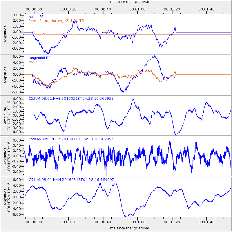
KAN08 Pence Farm, Harper, KS, USA - Earthquake Result Viewer
*The percent match for this event was below the threshold and hence no stack was calculated.
| Earthquake location: |
Andreanof Islands, Aleutian Is. |
| Earthquake latitude/longitude: |
51.5/-173.9 |
| Earthquake time(UTC): |
2016/03/13 (073) 04:19:25 GMT |
| Earthquake Depth: |
10 km |
| Earthquake Magnitude: |
5.5 MWC, 4.7 ML, 5.4 MB, 5.5 MWC |
| Earthquake Catalog/Contributor: |
NEIC PDE/NEIC COMCAT |
|
| Network: |
GS US Geological Survey Networks |
| Station: |
KAN08 Pence Farm, Harper, KS, USA |
| Lat/Lon: |
37.23 N/97.97 W |
| Elevation: |
375 m |
|
| Distance: |
53.7 deg |
| Az: |
73.841 deg |
| Baz: |
311.292 deg |
| Ray Param: |
$rayparam |
*The percent match for this event was below the threshold and hence was not used in the summary stack. |
|
| Radial Match: |
42.485565 % |
| Radial Bump: |
400 |
| Transverse Match: |
33.48074 % |
| Transverse Bump: |
400 |
| SOD ConfigId: |
1475611 |
| Insert Time: |
2016-04-15 23:47:49.263 +0000 |
| GWidth: |
2.5 |
| Max Bumps: |
400 |
| Tol: |
0.001 |
|
Signal To Noise
| Channel | StoN | STA | LTA |
| GS:KAN08:01:HHZ:20160313T04:28:16.56999Z | 0.78878814 | 1.4040893E-7 | 1.7800588E-7 |
| GS:KAN08:01:HHN:20160313T04:28:16.56999Z | 5.738783 | 4.505157E-6 | 7.85037E-7 |
| GS:KAN08:01:HHE:20160313T04:28:16.56999Z | 1.4057356 | 1.822983E-6 | 1.2968178E-6 |
| Arrivals |
| Ps | |
| PpPs | |
| PsPs/PpSs | |


