M18A Lyman, WY, USA - Earthquake Result Viewer
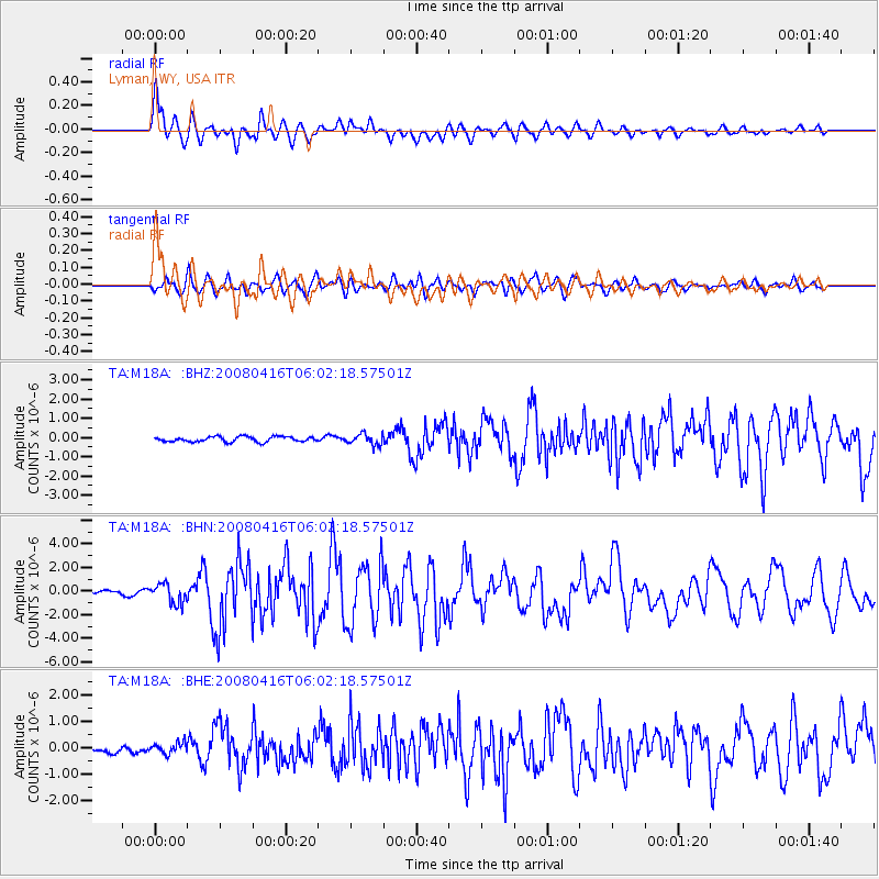
Earthquake location: Andreanof Islands, Aleutian Is.
Earthquake latitude/longitude: 51.9/-179.2
Earthquake time(UTC): 2008/04/16 (107) 05:54:19 GMT
Earthquake Depth: 13 km
Earthquake Magnitude: 6.1 MB, 6.5 MS, 6.6 MW, 6.6 MW
Earthquake Catalog/Contributor: WHDF/NEIC
Network: TA USArray Transportable Network (new EarthScope stations)
Station: M18A Lyman, WY, USA
Lat/Lon: 41.43 N/110.07 W
Elevation: 2103 m
Distance: 46.9 deg
Az: 74.253 deg
Baz: 307.495 deg
Ray Param: 0.07035465
Estimated Moho Depth: 14.5 km
Estimated Crust Vp/Vs: 1.60
Assumed Crust Vp: 6.155 km/s
Estimated Crust Vs: 3.847 km/s
Estimated Crust Poisson's Ratio: 0.18
Radial Match: 86.64476 %
Radial Bump: 400
Transverse Match: 71.71916 %
Transverse Bump: 400
SOD ConfigId: 2504
Insert Time: 2010-03-06 06:16:46.485 +0000
GWidth: 2.5
Max Bumps: 400
Tol: 0.001

Signal To Noise

ChannelStoNSTALTA
TA:M18A: :BHN:20080416T06:02:18.57501Z3.17090188.3330013E-72.6279594E-7
TA:M18A: :BHE:20080416T06:02:18.57501Z0.83935251.982096E-72.3614585E-7
TA:M18A: :BHZ:20080416T06:02:18.57501Z2.15252762.8948259E-71.3448495E-7
Arrivals
Ps1.5 SECOND
PpPs5.8 SECOND
PsPs/PpSs7.3 SECOND