You are here: Home > Network List > TA - USArray Transportable Network (new EarthScope stations) Stations List
> Station D24K Happy Valley, AK, USA > Earthquake Result Viewer
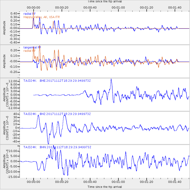
D24K Happy Valley, AK, USA - Earthquake Result Viewer

| Earthquake location: |
Iran-Iraq Border Region |
| Earthquake latitude/longitude: |
34.9/46.0 |
| Earthquake time(UTC): |
2017/11/12 (316) 18:18:17 GMT |
| Earthquake Depth: |
19 km |
| Earthquake Magnitude: |
7.3 Mww |
| Earthquake Catalog/Contributor: |
NEIC PDE/us |
|
| Network: |
TA USArray Transportable Network (new EarthScope stations) |
| Station: |
D24K Happy Valley, AK, USA |
| Lat/Lon: |
69.15 N/148.82 W |
| Elevation: |
292 m |
|
| Distance: |
75.7 deg |
| Az: |
5.408 deg |
| Baz: |
347.503 deg |
| Ray Param: |
0.051491484 |
| Estimated Moho Depth: |
10.5 km |
| Estimated Crust Vp/Vs: |
1.73 |
| Assumed Crust Vp: |
6.316 km/s |
| Estimated Crust Vs: |
3.651 km/s |
| Estimated Crust Poisson's Ratio: |
0.25 |
|
| Radial Match: |
93.90376 % |
| Radial Bump: |
400 |
| Transverse Match: |
90.067375 % |
| Transverse Bump: |
400 |
| SOD ConfigId: |
13570011 |
| Insert Time: |
2019-04-29 04:33:32.935 +0000 |
| GWidth: |
2.5 |
| Max Bumps: |
400 |
| Tol: |
0.001 |
|
Signal To Noise
| Channel | StoN | STA | LTA |
| TA:D24K: :BHZ:20171112T18:29:29.949973Z | 59.75211 | 1.7619855E-5 | 2.9488257E-7 |
| TA:D24K: :BHN:20171112T18:29:29.949973Z | 13.016447 | 4.631818E-6 | 3.5584347E-7 |
| TA:D24K: :BHE:20171112T18:29:29.949973Z | 2.582399 | 7.455355E-7 | 2.886988E-7 |
| Arrivals |
| Ps | 1.3 SECOND |
| PpPs | 4.4 SECOND |
| PsPs/PpSs | 5.6 SECOND |


