You are here: Home > Network List > GS - US Geological Survey Networks Stations List
> Station DEC06 Boomer > Earthquake Result Viewer
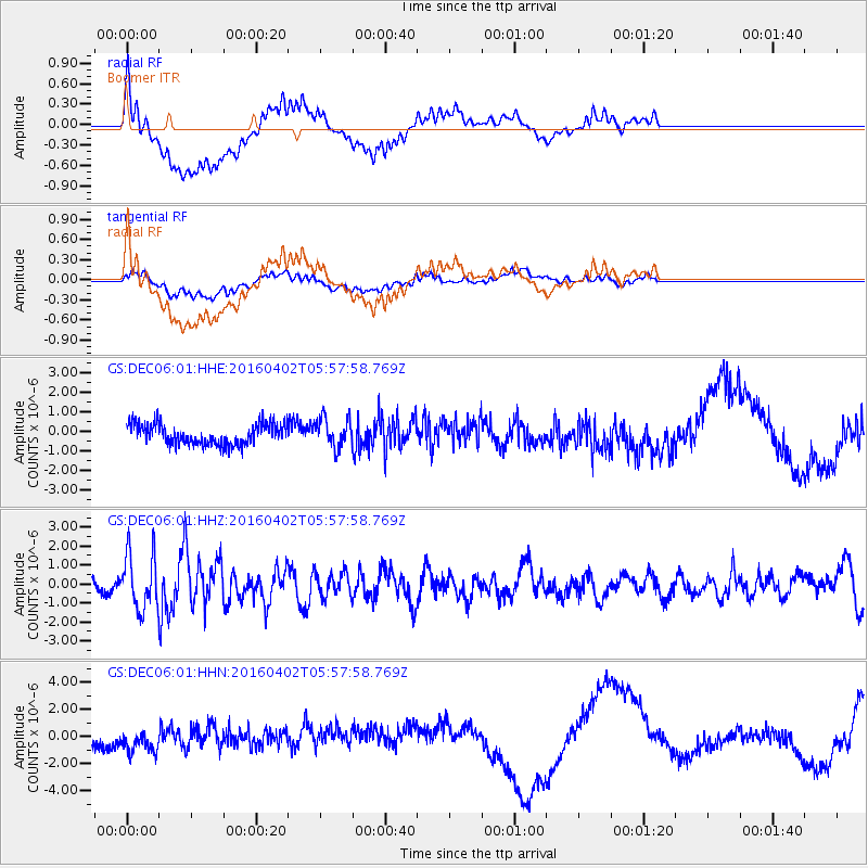
DEC06 Boomer - Earthquake Result Viewer
*The percent match for this event was below the threshold and hence no stack was calculated.
| Earthquake location: |
Alaska Peninsula |
| Earthquake latitude/longitude: |
57.0/-158.0 |
| Earthquake time(UTC): |
2016/04/02 (093) 05:50:00 GMT |
| Earthquake Depth: |
10 km |
| Earthquake Magnitude: |
6.2 MWP, 6.4 MI |
| Earthquake Catalog/Contributor: |
NEIC PDE/NEIC COMCAT |
|
| Network: |
GS US Geological Survey Networks |
| Station: |
DEC06 Boomer |
| Lat/Lon: |
39.90 N/88.95 W |
| Elevation: |
215 m |
|
| Distance: |
46.7 deg |
| Az: |
80.639 deg |
| Baz: |
315.49 deg |
| Ray Param: |
$rayparam |
*The percent match for this event was below the threshold and hence was not used in the summary stack. |
|
| Radial Match: |
47.72278 % |
| Radial Bump: |
400 |
| Transverse Match: |
45.701817 % |
| Transverse Bump: |
400 |
| SOD ConfigId: |
1475611 |
| Insert Time: |
2016-04-16 05:57:20.524 +0000 |
| GWidth: |
2.5 |
| Max Bumps: |
400 |
| Tol: |
0.001 |
|
Signal To Noise
| Channel | StoN | STA | LTA |
| GS:DEC06:01:HHZ:20160402T05:57:58.769Z | 6.542445 | 1.4411271E-6 | 2.2027348E-7 |
| GS:DEC06:01:HHN:20160402T05:57:58.769Z | 1.6116139 | 1.2382166E-6 | 7.6830844E-7 |
| GS:DEC06:01:HHE:20160402T05:57:58.769Z | 1.4121418 | 7.4332763E-7 | 5.2638313E-7 |
| Arrivals |
| Ps | |
| PpPs | |
| PsPs/PpSs | |


