M18A Lyman, WY, USA - Earthquake Result Viewer
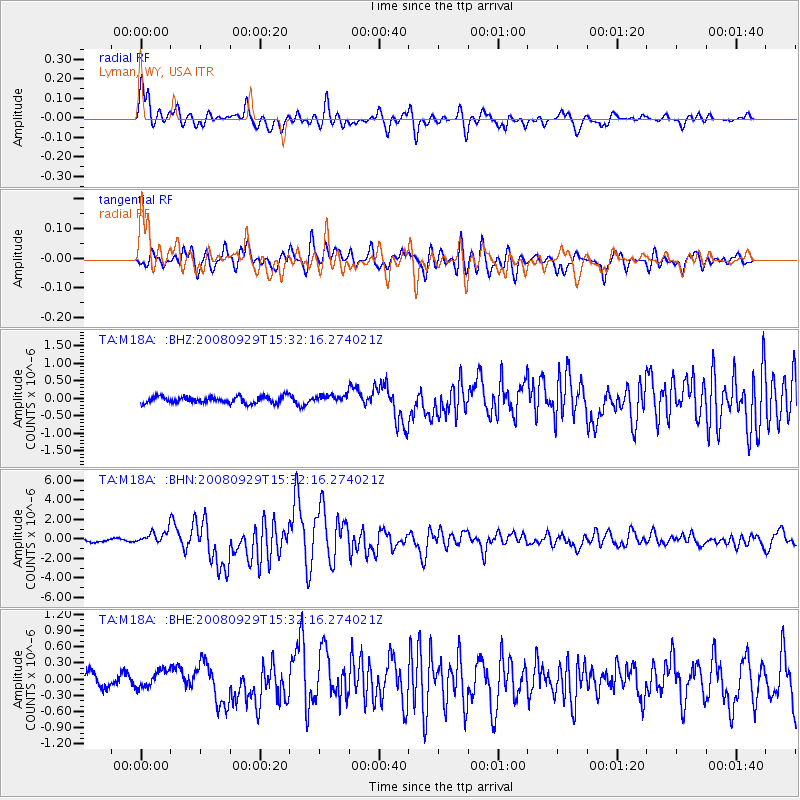
Earthquake location: Kermadec Islands, New Zealand
Earthquake latitude/longitude: -29.8/-177.7
Earthquake time(UTC): 2008/09/29 (273) 15:19:31 GMT
Earthquake Depth: 36 km
Earthquake Magnitude: 6.5 MB, 6.7 MS, 7.0 MW, 7.0 MW
Earthquake Catalog/Contributor: WHDF/NEIC
Network: TA USArray Transportable Network (new EarthScope stations)
Station: M18A Lyman, WY, USA
Lat/Lon: 41.43 N/110.07 W
Elevation: 2103 m
Distance: 94.4 deg
Az: 44.217 deg
Baz: 233.747 deg
Ray Param: 0.041040994
Estimated Moho Depth: 37.5 km
Estimated Crust Vp/Vs: 1.97
Assumed Crust Vp: 6.155 km/s
Estimated Crust Vs: 3.132 km/s
Estimated Crust Poisson's Ratio: 0.33
Radial Match: 91.306465 %
Radial Bump: 400
Transverse Match: 84.88715 %
Transverse Bump: 400
SOD ConfigId: 2560
Insert Time: 2010-03-06 06:17:15.966 +0000
GWidth: 2.5
Max Bumps: 400
Tol: 0.001

Signal To Noise

ChannelStoNSTALTA
TA:M18A: :BHN:20080929T15:32:16.274021Z5.2130576.705896E-71.2863653E-7
TA:M18A: :BHE:20080929T15:32:16.274021Z1.6083531.5853728E-79.8571185E-8
TA:M18A: :BHZ:20080929T15:32:16.274021Z1.13487951.0819488E-79.533601E-8
Arrivals
Ps6.0 SECOND
PpPs18 SECOND
PsPs/PpSs24 SECOND