
M18A Lyman, WY, USA - Earthquake Result Viewer
| ||||||||||||||||||
| ||||||||||||||||||
| ||||||||||||||||||
|
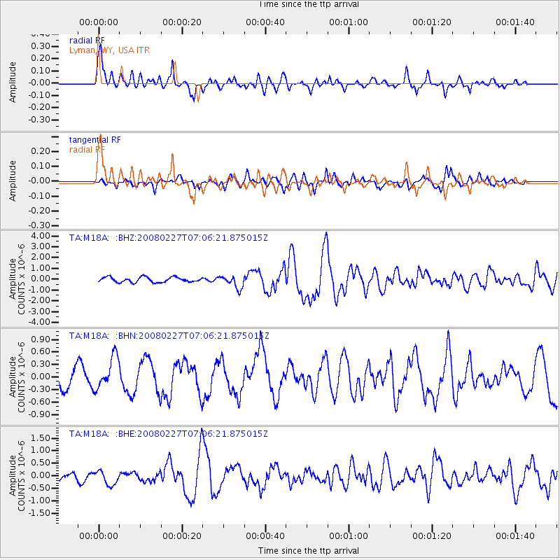
Signal To Noise
| Channel | StoN | STA | LTA |
| TA:M18A: :BHN:20080227T07:06:21.875015Z | 2.5731075 | 4.0481066E-7 | 1.5732365E-7 |
| TA:M18A: :BHE:20080227T07:06:21.875015Z | 1.7508085 | 3.0447472E-7 | 1.739052E-7 |
| TA:M18A: :BHZ:20080227T07:06:21.875015Z | 2.5969088 | 6.020172E-7 | 2.3182069E-7 |
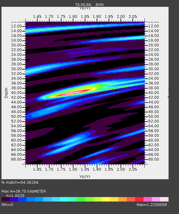
| Arrivals | |
| Ps | 5.3 SECOND |
| PpPs | 18 SECOND |
| PsPs/PpSs | 23 SECOND |

