M18A Lyman, WY, USA - Earthquake Result Viewer
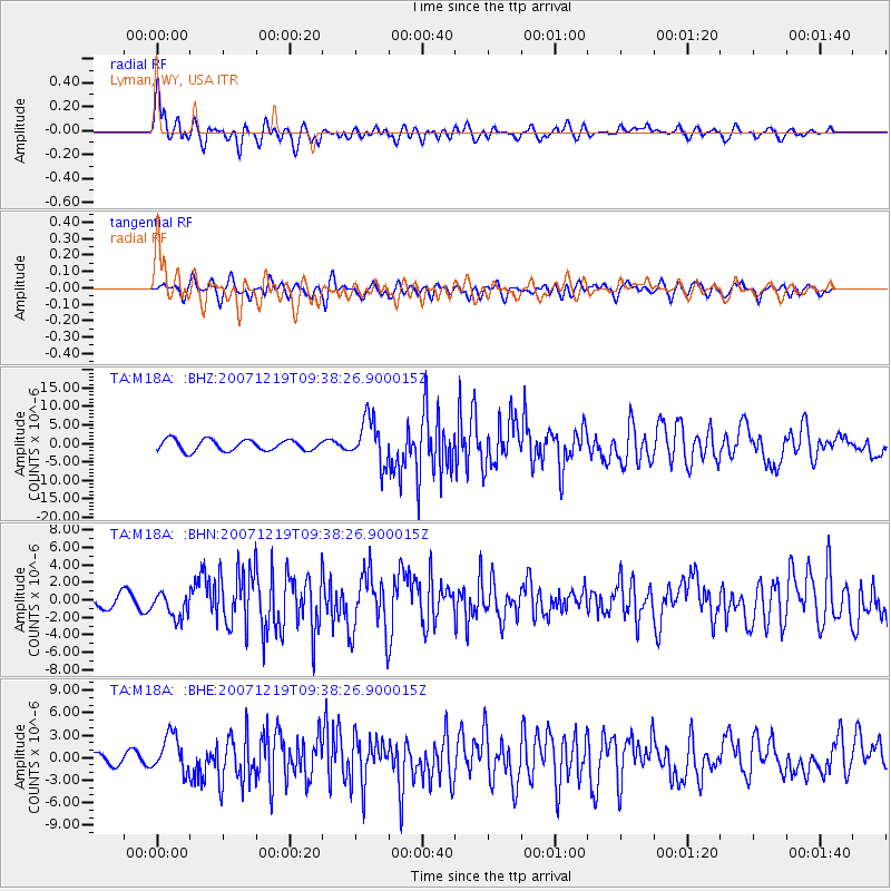
Earthquake location: Andreanof Islands, Aleutian Is.
Earthquake latitude/longitude: 51.4/-179.5
Earthquake time(UTC): 2007/12/19 (353) 09:30:27 GMT
Earthquake Depth: 29 km
Earthquake Magnitude: 6.4 MB, 7.1 MS, 7.1 MW, 7.0 MW
Earthquake Catalog/Contributor: WHDF/NEIC
Network: TA USArray Transportable Network (new EarthScope stations)
Station: M18A Lyman, WY, USA
Lat/Lon: 41.43 N/110.07 W
Elevation: 2103 m
Distance: 47.2 deg
Az: 73.57 deg
Baz: 306.903 deg
Ray Param: 0.07006916
Estimated Moho Depth: 20.75 km
Estimated Crust Vp/Vs: 1.92
Assumed Crust Vp: 6.155 km/s
Estimated Crust Vs: 3.197 km/s
Estimated Crust Poisson's Ratio: 0.32
Radial Match: 83.41716 %
Radial Bump: 400
Transverse Match: 59.633312 %
Transverse Bump: 400
SOD ConfigId: 2564
Insert Time: 2010-03-06 06:17:36.086 +0000
GWidth: 2.5
Max Bumps: 400
Tol: 0.001

Signal To Noise

ChannelStoNSTALTA
TA:M18A: :BHN:20071219T09:38:26.900015Z2.0561051.4299242E-66.9545297E-7
TA:M18A: :BHE:20071219T09:38:26.900015Z3.3660092.4582573E-67.303181E-7
TA:M18A: :BHZ:20071219T09:38:26.900015Z4.1327276.085804E-61.4725878E-6
Arrivals
Ps3.3 SECOND
PpPs9.4 SECOND
PsPs/PpSs13 SECOND