You are here: Home > Network List > TA - USArray Transportable Network (new EarthScope stations) Stations List
> Station M18A Lyman, WY, USA > Earthquake Result Viewer
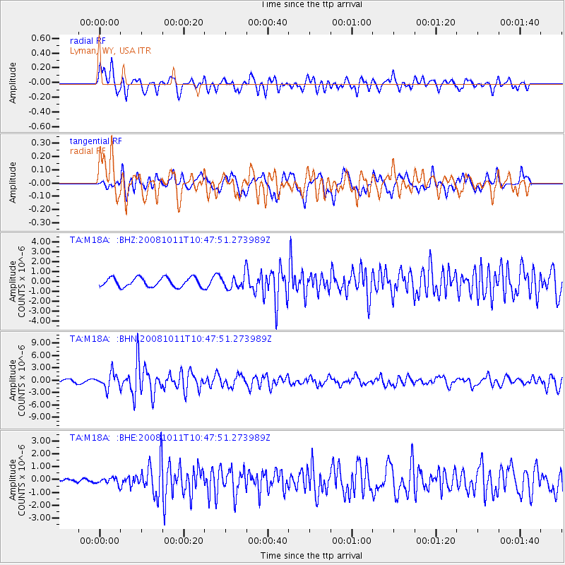
M18A Lyman, WY, USA - Earthquake Result Viewer
*The percent match for this event was below the threshold and hence no stack was calculated.
| Earthquake location: |
Virgin Islands |
| Earthquake latitude/longitude: |
19.2/-64.8 |
| Earthquake time(UTC): |
2008/10/11 (285) 10:40:14 GMT |
| Earthquake Depth: |
23 km |
| Earthquake Magnitude: |
6.1 MB, 5.9 MS, 6.1 MW, 6.0 MW |
| Earthquake Catalog/Contributor: |
WHDF/NEIC |
|
| Network: |
TA USArray Transportable Network (new EarthScope stations) |
| Station: |
M18A Lyman, WY, USA |
| Lat/Lon: |
41.43 N/110.07 W |
| Elevation: |
2103 m |
|
| Distance: |
44.3 deg |
| Az: |
310.145 deg |
| Baz: |
106.079 deg |
| Ray Param: |
$rayparam |
*The percent match for this event was below the threshold and hence was not used in the summary stack. |
|
| Radial Match: |
80.358826 % |
| Radial Bump: |
400 |
| Transverse Match: |
72.87948 % |
| Transverse Bump: |
400 |
| SOD ConfigId: |
2556 |
| Insert Time: |
2010-03-06 06:18:11.197 +0000 |
| GWidth: |
2.5 |
| Max Bumps: |
400 |
| Tol: |
0.001 |
|
Signal To Noise
| Channel | StoN | STA | LTA |
| TA:M18A: :BHN:20081011T10:47:51.273989Z | 4.583489 | 1.849904E-6 | 4.0360175E-7 |
| TA:M18A: :BHE:20081011T10:47:51.273989Z | 1.0793319 | 2.4603457E-7 | 2.2795082E-7 |
| TA:M18A: :BHZ:20081011T10:47:51.273989Z | 1.5497074 | 7.0873136E-7 | 4.5733236E-7 |
| Arrivals |
| Ps | |
| PpPs | |
| PsPs/PpSs | |


