You are here: Home > Network List > TA - USArray Transportable Network (new EarthScope stations) Stations List
> Station M18A Lyman, WY, USA > Earthquake Result Viewer
M18A Lyman, WY, USA - Earthquake Result Viewer
*The percent match for this event was below the threshold and hence no stack was calculated.
| Earthquake location: |
Near East Coast Of Honshu, Japan |
| Earthquake latitude/longitude: |
36.2/141.5 |
| Earthquake time(UTC): |
2008/05/07 (128) 16:02:02 GMT |
| Earthquake Depth: |
19 km |
| Earthquake Magnitude: |
5.7 MB, 6.2 MW, 6.2 MW |
| Earthquake Catalog/Contributor: |
WHDF/NEIC |
|
| Network: |
TA USArray Transportable Network (new EarthScope stations) |
| Station: |
M18A Lyman, WY, USA |
| Lat/Lon: |
41.43 N/110.07 W |
| Elevation: |
2103 m |
|
| Distance: |
78.7 deg |
| Az: |
46.689 deg |
| Baz: |
308.476 deg |
| Ray Param: |
$rayparam |
*The percent match for this event was below the threshold and hence was not used in the summary stack. |
|
| Radial Match: |
70.71125 % |
| Radial Bump: |
400 |
| Transverse Match: |
64.23772 % |
| Transverse Bump: |
400 |
| SOD ConfigId: |
2504 |
| Insert Time: |
2010-03-06 06:18:35.065 +0000 |
| GWidth: |
2.5 |
| Max Bumps: |
400 |
| Tol: |
0.001 |
|
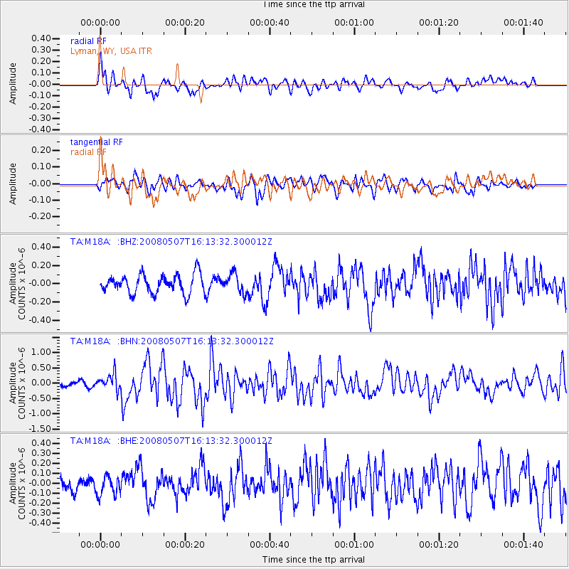
Signal To Noise
| Channel | StoN | STA | LTA |
| TA:M18A: :BHN:20080507T16:13:32.300012Z | 2.627422 | 2.6787944E-7 | 1.0195524E-7 |
| TA:M18A: :BHE:20080507T16:13:32.300012Z | 0.986137 | 9.312824E-8 | 9.443743E-8 |
| TA:M18A: :BHZ:20080507T16:13:32.300012Z | 1.0286708 | 1.0456368E-7 | 1.0164932E-7 |
| Arrivals |
| Ps | |
| PpPs | |
| PsPs/PpSs | |


